مقاطعة برجن، نيو جرسي
| ||||||||||||||||||||||||||||||||||||||||||||||||||||||
 خريطة تفاعلية لمقاطعة برجن، نيوجرزي | ||||||||||||||||||||||||||||||||||||||||||||||||||||||


مقاطعة برگن Bergen County، هي أكثر مقاطعة اكتظاظاً بالسكان في ولاية نيوجرزي، الولايات المتحدة.[5] ففي تقدير التعداد لعام 2017، بلغ تعداد المقاطعة 948,406 نسمة، بزيادة 4.8% عن تعداد 2010،[7][8][9] الذي مثل بدوره زيادة قدرها 20,998 نسمة (2.4%) عن 884,118 نسمة في تعداد 2000.[10] المقاطعة هي جزء من منطقة مدينة نيويورك الكبرى. وتقع، عبر نهر الهدسون، مباشرةً مقابل منهاتن، التي يربطها به جسر جورج واشنطن.
تنقسم مقاطعة برگن إلى 70 بلدية، إلا أنها لا تضم مدناً كبيرة. فأكبر أماكنها، بتعداد 43,010 نسمة في تعداد 2010، هو هاكنساك،[11] التي هي أيضاً مقر المقاطعة.[12] ماوا تغطي أكبر مساحة بلدية، 67.8 كم².
As of the 2020 United States census, the county's population was 955,732,[3][4] its highest decennial count ever and an increase of 50,616 (+5.6%) from the 905,116 recorded at the 2010 census,[13] which in turn reflected an increase of 20,998 (2.4%) from the 884,118 counted in the 2000 census.[11] The United States Census Bureau's Population Estimates Program estimated a 2025 population of 977,026, an increase of 21,294 (+2.2%) from the 2020 decennial census.[5]
The county is divided into 70 municipalities, the most of any county in New Jersey, made up of 56 boroughs, nine townships, three cities, and two villages. Its most populous place, with 46,030 residents as of the 2020 census, is Hackensack,[4] which is also its county seat.[12] Mahwah covers the largest area of any municipality, at 26.19 ميل مربع (67.8 km2).[11]
Bergen County is one of the largest commercial hubs in both New Jersey and the United States, generating over $6 billion in annual revenues from retailers in Paramus alone, despite blue laws keeping most stores in the county and especially Paramus itself (which has even stricter blue laws than the rest of the county) open only six days per week.[14] The county is one of the wealthiest counties in the United States, with a median household income of $109,497 (compared to $89,703 in New Jersey and $69,021 nationwide) and a per capita income of $55,710 (vs. $46,691 in the state and $37,638 in the U.S.) as of the 2017–2021 American Community Survey.[15] Bergen County has some of the highest home prices in the United States, with the median sale price approximately $900,000 as of 2025 and maximum prices in the tens of millions of dollars.[16][17] The county's park system includes 21 parks covering more than 9،800 acre (4،000 ha).[18]
أصل الاسم
The origin of the name of Bergen County is a matter of debate. It is believed that the county is named for one of the earliest settlements, Bergen, in modern-day Hudson County. However, the origin of the township's name is debated. Several sources attribute the name to Bergen, Norway, while others attribute it to Bergen, North Holland in the Netherlands.[1] Some sources say that the name is derived from one of the earliest settlers of New Amsterdam (now New York City), Hans Hansen Bergen, a native of Norway, who arrived in New Netherland in 1633.[19][20]
التاريخ


At the time of first European contact, Bergen County was inhabited by Native American people, particularly the Lenape Nation, whose subgroups included the Tappan, Hackensack, and Rumachenanck (later called the Haverstraw), as named by the Dutch colonists.[21] Some of their descendants are included among the Ramapough Mountain Indians, recognized as a tribe by the state in 1980.[22] Their ancestors had moved into the mountains to escape encroachment by Dutch and English colonists. Their descendants reside mostly in the northwest of the county, in nearby Passaic County and in Rockland County, New York, tracing their Lenape ancestry to speakers of the Munsee language, one of three major dialects of their language.[23] Over the years, they absorbed other ethnicities by intermarriage.[24]
In the 17th century, the Dutch considered the area comprising today's Bergen and Hudson counties as part of New Netherland, their colonial province of the Dutch Republic. The Dutch claimed it after Henry Hudson (sailing for the Dutch East India Company) explored Newark Bay and anchored his ship at Weehawken Cove in 1609.[25] From an early date, the Dutch began to import African slaves to fill their labor needs. Bergen County eventually was the largest slaveholding county in the state, with nearly 20% of its population consisting of slaves in 1800.[26] The African slaves were used for labor at the ports to support shipping, as well as for domestic servants, trades, and farm labor.
Early settlement attempts by the Dutch colonists included Pavonia (1633), Vriessendael (1640), and Achter Col (1642), but the Native Americans repelled these settlements in Kieft's War (1643–1645) and the Peach War (1655).[27][28] European settlers returned to the western shores of the Hudson River in the 1660 formation of Bergen Township (now part of Jersey City, New Jersey), which would become one of the earliest permanent European settlements in present-day New Jersey.[29][30]
During the Second Anglo-Dutch War, on August 27, 1664, New Amsterdam's governor Peter Stuyvesant surrendered to the English Navy.[31] The English organized the Province of New Jersey in 1665, later splitting the territory into East Jersey and West Jersey in 1674. On November 30, 1675, the settlement Bergen and surrounding plantations and settlements were called Bergen County in an act passed by the province's General Assembly.[32] In 1683, Bergen (along with the three other original counties of East Jersey) was officially recognized as an independent county by the Provincial Assembly.[33][34]
Initially, Bergen County comprised only the land between the Hudson River and the Hackensack River, extending north to the border between East Jersey and New York.[35] In January 1709, the boundaries were extended to include all of the current territory of Hudson County (formed in 1840) and portions of the current territory of Passaic County (formed in 1837). The 1709 borders were described as follows:[35]
- "Beginning at Constable's Hook, so along the bay and Hudson's River to the partition point between New Jersey and the province of New York; along this line and the line between East and West Jersey† to the Pequaneck River; down the Pequaneck and Passaic Rivers to the sound; and so following the sound to Constable's Hook the place of beginning."
- † The line between East and West Jersey here referred to is not the line finally adopted and known as the Lawrence line, which was run by John Lawrence in September and October 1743. It was the compromise line agreed upon between Governors Daniel Coxe and Robert Barclay in 1682, which ran a little north of Morristown to the Passaic River; thence up the Pequaneck to forty-one degrees of north latitude; and thence by a straight line due east to the New York State line. This line being afterward objected to by the East Jersey proprietors, the latter procured the running of the Lawrence line.[35]
Bergen was the location of several battles and troop movements during the American Revolutionary War. Fort Lee's location on the bluffs of the New Jersey Palisades, opposite Fort Washington in Manhattan, made it a strategic position during the war. In November 1776, the Battle of Fort Lee took place as part of a British plan to capture George Washington and to resoundingly defeat the Continental Army, whose forces were divided and located in Fort Lee and Hackensack. After abandoning the defenses in Fort Lee and leaving behind considerable supplies, the Continental forces staged a hasty retreat through present-day Englewood, Teaneck, and Bergenfield, and across the Hackensack River at New Bridge Landing, one of the few sites where the river was crossed by a bridge. They destroyed the bridge to delay the British assault on Washington's headquarters in the village of Hackensack. The next day, George Washington retreated to Newark and left Hackensack via Polifly Road. British forces pursued, and Washington continued to retreat across New Jersey. The retreat allowed American forces to escape capture and regroup for subsequent successes against the British elsewhere in New Jersey later that winter.[36]
Soon after the Battle of Princeton in January 1777, British forces realized that they were not able to spread themselves thin across New Jersey. Local militia retook Hackensack and the rest of Bergen County. Bergen County saw skirmishes throughout the war as armies from both sides maneuvered across the countryside.
The Baylor Massacre took place in 1778 in River Vale, resulting in severe losses for the Continentals.[37]
In 1837, Passaic County was formed from parts of Bergen and Essex counties. In 1840, Hudson County was formed from Bergen. These two divisions took roughly 13,000 residents (nearly half of the previous population) from the county's rolls.[34][38]
In 1852, the Erie Railroad began operating major rail services from Jersey City on the Hudson River to points north and west via leased right-of-way in the county. This became known as the Erie Main Line, and is still in use for passenger service today.[39] The Erie later leased two other railroads built in the 1850s and 1860s, later known as the Pascack Valley Line and the Northern Branch, and in 1881 built a cutoff, now the Bergen County Line. There were two other rail lines in the county, ultimately known as the West Shore Railroad and the New York, Susquehanna, and Western.
In 1894, state law was changed to allow easy formation of municipalities with the borough form of government. This led to the "boroughitis" phenomenon, in which many new municipalities were created in a span of a few years.[40] There were 26 boroughs that were formed in the county in 1894 alone, with two more boroughs (and one new township) formed in 1895.[41] Ultimately 56 boroughs were incorporated in Bergen County, the highest number for any county in New Jersey.
On January 11, 1917, the Kingsland explosion took place at a munitions factory in what is today Lyndhurst.[42] The explosion is believed to have been an act of sabotage by German agents, as the munitions in question were destined for Russia, part of the U.S.'s effort to supply allies before entrance into World War I.[43] After the U.S. entry into the war in April 1917, Camp Merritt was created in eastern Bergen County for troop staging. Beginning operations in August 1917, it housed 50,000 soldiers at a time, staging them for deployment to Europe via Hoboken. Camp Merritt was decommissioned in November 1919.[44]
The George Washington Bridge was completed in 1931, linking Fort Lee to Manhattan. This connection spurred rapid development in the post-World War II era, developing much of the county to suburban levels. Two lanes were added to the upper level in 1946 and a second deck of traffic on the bridge was completed in 1962, expanding its capacity to becoming the world's only 14-lane suspension bridge.[45] The bridge is the world's busiest motor vehicle bridge, carrying 104 million vehicles in 2019.[46]
In 1955, the United States Army established a Nike Missile station at Campgaw Mountain (in the west of the county) for the defense of the New York Metropolitan Area from strategic bombers. In 1959, the site was upgraded to house Nike-Hercules Missiles with increased range, speed, and payload characteristics. The missile site closed in June 1971.[47]
الجغرافيا

أماكن قريبة من مقاطعة برجن، نيو جرسي | ||||||||||
|---|---|---|---|---|---|---|---|---|---|---|
| ||||||||||


Bergen County is located at the northeastern corner of the state of New Jersey and is bordered by Rockland County, New York, to the north; by Manhattan and the Bronx in New York City, as well as by Westchester County, New York, across the Hudson River to the east; and within New Jersey, by Hudson County as well as a small border with Essex County to the south, and by Passaic County to the west.[48]
According to the U.S. Census Bureau, as of the 2020 Census, the county had a total area of 246.45 ميل مربع (638.3 km2), of which 232.79 ميل مربع (602.9 km2) was land (94.5%) and 13.66 ميل مربع (35.4 km2) was water (5.5%).[49]
أعلى منسوب في مقاطعة برگن هو الجبل الأصلع بالقرب من خط الحدود مع ولاية نيويورك في ماوا، على ارتفاع 351 متر فوق سطح البحر.[50][51] The county's lowest point is sea level, along the Hudson River, which in this region is a tidal estuary.
The sharp cliffs of the New Jersey Palisades lift much of the eastern boundary of the county up from the Hudson River. The relief becomes less pronounced across the middle section of the county, much of it being located in the Hackensack River valley or the Pascack Valley. In the northwestern portion of the county, Bergen County becomes hilly again and shares the Ramapo Mountains with Rockland County, New York.
The damming of the Hackensack River and a tributary, the Pascack Brook, produced three reservoirs in the county, Woodcliff Lake Reservoir (which impounds one billion gallons of water), Lake Tappan (3.5 billion gallons), and Oradell Reservoir, which allows United Water to provide drinking water to 750,000 residents of North Jersey, mostly in Bergen and Hudson counties.[52] The Hackensack River drains the eastern portion of the county through the New Jersey Meadowlands, a wetlands area in the southern portion of the county. The central portion is drained by the Saddle River and the western portion is drained by the Ramapo River. Both of these are tributaries of the Passaic River, which forms a section of the southwestern border of the county.
المناخ
| Hackensack, New Jersey | ||||||||||||||||||||||||||||||||||||||||||||||||||||||||||||
|---|---|---|---|---|---|---|---|---|---|---|---|---|---|---|---|---|---|---|---|---|---|---|---|---|---|---|---|---|---|---|---|---|---|---|---|---|---|---|---|---|---|---|---|---|---|---|---|---|---|---|---|---|---|---|---|---|---|---|---|---|
| جدول الطقس (التفسير) | ||||||||||||||||||||||||||||||||||||||||||||||||||||||||||||
| ||||||||||||||||||||||||||||||||||||||||||||||||||||||||||||
| ||||||||||||||||||||||||||||||||||||||||||||||||||||||||||||
Southeastern Bergen County lies at the edge of the humid subtropical climate zone (Cfa) according to the Köppen climate classification because its coldest month (January) averages above 26.6 °F (−3.0 °C).[54][55][56] In part due to Bergen's coastal location, its lower elevation, and the partial shielding of the county from colder air by the three ridges of the Watchung Mountains as well as by the higher Appalachians, the climate of Bergen County is milder than in New Jersey counties further inland such as Sussex County. Bergen County has a moderately sunny climate, averaging between 2,400 and 2,800 hours of sunshine annually.[57]
In recent years, average temperatures in the county seat of Hackensack have ranged from a low of 19 °F (−7 °C) in January to a high of 86 °F (30 °C) in July, although a record low of −15 °F (−26 °C) was recorded in February 1934 and a record high of 106 °F (41 °C) was recorded in July 1936. Average monthly precipitation ranged from 3.21 بوصات (82 mm) in February to 4.60 بوصات (117 mm) in July.[53]
Average monthly temperatures in Mahwah (measured at the interchange of Route 17 and MacArthur Boulevard) range from 28.5 °F (−1.9 °C) in January to 73.8 °F (23.2 °C) in July. Using the 32 °F (0 °C) January isotherm, most of Bergen has a hot-summer humid continental climate (Dfa) except for higher areas in the Ramapo Mountains, which are Dfb, and along the Hudson River from Fort Lee and southward, where Cfa exists.[58]
الديموغرافيا
The county hosts one of the largest population of Circassian Americans.[59][60]
| التعداد | Pop. | ملاحظة | %± |
|---|---|---|---|
| 1790 | 12٬601 | — | |
| 1800 | 15٬156 | 20٫3% | |
| 1810 | 16٬603 | 9٫5% | |
| 1820 | 18٬178 | 9٫5% | |
| 1830 | 22٬412 | 23٫3% | |
| 1840 | 13٬223 | * | −41�0% |
| 1850 | 14٬725 | 11٫4% | |
| 1860 | 21٬618 | 46٫8% | |
| 1870 | 30٬122 | 39٫3% | |
| 1880 | 36٬786 | 22٫1% | |
| 1890 | 47٬226 | 28٫4% | |
| 1900 | 78٬441 | 66٫1% | |
| 1910 | 138٬002 | 75٫9% | |
| 1920 | 210٬703 | 52٫7% | |
| 1930 | 364٬977 | 73٫2% | |
| 1940 | 409٬646 | 12٫2% | |
| 1950 | 539٬139 | 31٫6% | |
| 1960 | 780٬255 | 44٫7% | |
| 1970 | 897٬148 | 15�0% | |
| 1980 | 845٬385 | −5٫8% | |
| 1990 | 825٬380 | −2٫4% | |
| 2000 | 884٬118 | 7٫1% | |
| 2010 | 905٬116 | 2٫4% | |
| 2020 | 955٬732 | 5٫6% | |
| 2025 (تق.) | 977٬026 | [3][5] | 2٫2% |
| Historical sources: 1790–1990[61] 1970–2010[11] 2020[3][4] * = Territorial change in previous decade | |||

Racial and ethnic composition
| Race / Ethnicity (NH = Non-Hispanic) | Pop 1980[65] | Pop 1990[66] | Pop 2000[67] | Pop 2010[68] | Pop 2020[69] | % 1980 | % 1990 | % 2000 | % 2010 | % 2020 |
|---|---|---|---|---|---|---|---|---|---|---|
| White alone (NH) | 761,493 | 682,210 | 638,953 | 566,053 | 511,919 | 90.08% | 82.65% | 72.27% | 62.54% | 53.56% |
| Black or African American alone (NH) | 32,282 | 38,037 | 44,149 | 46,850 | 49,909 | 3.82% | 4.61% | 4.99% | 5.18% | 5.22% |
| Native American or Alaska Native alone (NH) | 706 | 936 | 824 | 869 | 811 | 0.08% | 0.11% | 0.09% | 0.10% | 0.08% |
| Asian alone (NH) | 19,723 | 53,776 | 93,979 | 130,491 | 157,500 | 2.33% | 6.52% | 10.63% | 14.42% | 16.48% |
| Native Hawaiian or Pacific Islander alone (NH) | x [70] | x [71] | 137 | 173 | 130 | x | x | 0.02% | 0.02% | 0.01% |
| Other race alone (NH) | 2,667 | 645 | 1,659 | 2,568 | 6,464 | 0.32% | 0.08% | 0.19% | 0.28% | 0.68% |
| Mixed race or Multiracial (NH) | x [72] | x [73] | 13,040 | 12,831 | 24,316 | x | x | 1.47% | 1.42% | 2.54% |
| Hispanic or Latino (any race) | 28,514 | 49,776 | 91,377 | 145,281 | 204,683 | 3.37% | 6.03% | 10.34% | 16.05% | 21.42% |
| Total | 845,385 | 825,380 | 884,118 | 905,116 | 955,732 | 100.00% | 100.00% | 100.00% | 100.00% | 100.00% |
تنوع السكان
Given its location as a suburban extension of Manhattan across the George Washington Bridge,[74] Bergen County has evolved a globally cosmopolitan ambience of its own, demonstrating a robust and growing demographic and cultural diversity with respect to metrics including nationality, religion, race, and domiciliary partnership. South Korea, Poland, and India are the three most common nations of birth for foreign-born Bergen County residents.[75]
Italian American
Italian Americans have long had a significant presence in Bergen County; in fact, Italian is the most commonly identified first ancestry among Bergen residents (18.5%), with 168,974 Bergen residents were recorded as being of Italian heritage in the 2013 American Community Survey.[76]
To this day, many residents of the Meadowlands communities in the county's south are of Italian descent, most notably in South Hackensack (36.3%), Lyndhurst (33.8%), Carlstadt (31.2%), Wood-Ridge (30.9%) and Hasbrouck Heights (30.8%).[77] Saddle Brook (29.8%), Lodi (29.4%), Moonachie (28.5%), Garfield, Hackensack, and the southeastern Bergen towns were Italian American strongholds for decades, but their Italo-American demographics have diminished in recent years as more recent immigrants have taken their place.[78] At the same time, the Italian American population has grown in many of the communities in the northern half of the county, including Franklin Lakes,[79] Ramsey,[80] Montvale,[81] and Woodcliff Lake.[82]
الأمريكان اليهود
Bergen County is home to the largest Jewish population in New Jersey.[83] العديد من البلدات في المقاطعة تضم أعداداً معتبرة من الأمريكان اليهود، بما في ذلك فير لون و تينك وتنافلاي، كلوستر، إنگلوود، إنگلوود كلفس, فورت لي، برگنفيلد، وودكلف ليك، پارامس و فرانكلن ليكس.[84] تينك و فير لون و إنگلوود و برگنفيلد بالذات أصبحن موئلاً متنامياً للطائفة اليهودية الأرثوذكسية في مقاطعة برگن، بأعداد متزايدة من الكنس وكذلك مراكز التسوق والمطاعم التي تبيع الطعام الكوشر.[85] The largest Israeli American communities in Bergen County were in Fair Lawn (2.5%), Closter (1.4%), and Tenafly (1.3%) in 2000, representing three of the four largest in the state.[86] Altogether, 83,700 Bergen residents identified themselves as being of Jewish heritage in 2000, a number expected to show an increase per a 2014 survey of Jews in the county.[84][85]
الأمريكان الكوريون
The top ten municipalities in the United States as ranked by Korean American percentage of overall population in 2010 are illustrated in the following table:
| الترتيب | البلدية | المقاطعة | الولاية | النسبة |
|---|---|---|---|---|
| 1 | پاليسيدز پارك[87] | مقاطعة برگن | نيوجرزي | 51٫5% |
| 2 | ليونيا | مقاطعة برگن | نيوجرزي | 26٫5% |
| 3 | ردجفيلد | مقاطعة برگن | نيوجرزي | 25٫7% |
| 4 | فورت لي | مقاطعة برگن | نيوجرزي | 23٫5% |
| 5 | كلوستر | مقاطعة برگن | نيوجرزي | 21٫2% |
| 6 | إنگلوود كلفس | مقاطعة برگن | نيوجرزي | 20٫3% |
| 7 | نوروود | مقاطعة برگن | نيوجرزي | 20٫1% |
| 8 | إدجواتر | مقاطعة برگن | نيوجرزي | 19٫6% |
| 9 | كرِسكِل | مقاطعة برگن | نيوجرزي | 17٫8% |
| 10 | دمارست | مقاطعة برگن | نيوجرزي | 17٫3% |
One of the fastest-growing immigrant groups in Bergen County[88] is the Korean American community, which is concentrated along the Hudson River – especially in the area near the George Washington Bridge – and represented more than half of the state's entire Korean population as of 2000.[89] As of the 2010 Census, persons of Korean ancestry made up 6.3% of Bergen County's population[90][91] (increasing to 6.9% by the 2011 American Community Survey to an estimated 63,247 individuals),[92] which is the highest percentage for any county in the United States;[91] while the concentration of Koreans in Palisades Park, within Bergen County, is the highest density and percentage of any municipality in the United States,[93] at 52.5% of the population.[87] Per the 2010 Census, Palisades Park was home to the highest total number (10,115)[87] of individuals of Korean ancestry among all municipalities in the state,[94] while neighboring Fort Lee had the second largest cluster (8,318),[95] and fourth highest proportion (23.5%, trailing Leonia (26.5%) and Ridgefield (25.7%)). All of the nation's top ten municipalities by percentage of Korean population in 2010 were located in Bergen County,[96] including Palisades Park, Leonia, Ridgefield, Fort Lee, Closter, Englewood Cliffs, Norwood, Edgewater, Cresskill, and Demarest, closely followed by Old Tappan. Virtually all of the municipalities with the highest Korean concentrations are located in the eastern third of the county, near the Hudson River, although Ridgewood has emerged as a Korean American nexus in western Bergen County,[97] and Paramus[98] and River Edge[99] in central Bergen County. Beginning in 2012, county election ballots were printed in the Korean Hangul (한글) language,[100] in addition to English and Spanish, given the U.S Census Bureau's directive that Bergen County's Korean population had grown large enough to warrant language assistance during elections.[101] Korean chaebols have established North American headquarters operations in Bergen County, including Samsung,[102] LG Corp,[103] and Hanjin Shipping.[104] In April 2018, the largest Korean-themed supermarket in Bergen County opened in Paramus.[105] In January 2019, Christopher Chung was sworn in as the first Korean-American mayor of Palisades Park.[106]
الأمريكان المسلمون
Muslims
Bergen County also has a moderate-sized Muslim population, which numbered 6,473 as of the 2000 census.[84] Teaneck and Hackensack have emerged as the two most significant Muslim enclaves in the county, with the American Muslim Union's 18th annual brunch gathering held in Teaneck in 2016.[107][108] Bergen's Muslim population primarily consists of Arab Americans, South Asian Americans, African Americans, and more recently, Macedonian Americans and Albanian Americans, although many members of these groups practice other religions.[109] While Arab Americans have not established a significant presence in any particular municipality, in total there are 11,755 county residents who indicated Arab ancestry in the 2000 census.[110] The overwhelming majority of Bergen's Arab American population (64.3%) is constituted by persons of Lebanese (2,576),[111] Syrian (2,568),[112] and Egyptian (2,417)[113] descent. The county's diners provide late-night and pre-dawn dining options during the Islamic holy month of Ramadan.[114]
تكلفة الإسكان
القانون والحكومة
حكومة المقاطعة

تمثيل الولاية
التمثيل في الكونگرس
السياسة
| السنة | الجمهوري | الديمقراطي | حزب ثالث | |||
|---|---|---|---|---|---|---|
| رقم. | % | رقم. | % | رقم. | % | |
| 1896 | 8,545 | 62٫07% | 4,531 | 32٫91% | 690 | 5٫01% |
| 1900 | 9,086 | 56٫91% | 6,458 | 40٫45% | 422 | 2٫64% |
| 1904 | 9,957 | 54٫65% | 7,301 | 40٫08% | 960 | 5٫27% |
| 1908 | 14,043 | 61٫51% | 7,629 | 33٫42% | 1,158 | 5٫07% |
| 1912 | 5,087 | 20٫46% | 9,978 | 40٫12% | 9,803 | 39٫42% |
| 1916 | 18,494 | 60٫05% | 11,530 | 37٫44% | 773 | 2٫51% |
| 1920 | 47,512 | 76٫26% | 12,396 | 19٫90% | 2,397 | 3٫85% |
| 1924 | 60,803 | 69٫41% | 16,844 | 19٫23% | 9,951 | 11٫36% |
| 1928 | 89,105 | 63٫62% | 50,373 | 35٫96% | 589 | 0٫42% |
| 1932 | 86,885 | 52٫42% | 73,921 | 44٫60% | 4,937 | 2٫98% |
| 1936 | 89,628 | 49٫28% | 91,107 | 50٫09% | 1,143 | 0٫63% |
| 1940 | 131,588 | 63٫01% | 76,541 | 36٫65% | 694 | 0٫33% |
| 1944 | 142,836 | 65�00% | 76,350 | 34٫74% | 566 | 0٫26% |
| 1948 | 142,657 | 65٫70% | 69,132 | 31٫84% | 5,342 | 2٫46% |
| 1952 | 212,842 | 69٫22% | 93,373 | 30٫37% | 1,287 | 0٫42% |
| 1956 | 254,334 | 75٫22% | 82,169 | 24٫30% | 1,610 | 0٫48% |
| 1960 | 224,969 | 58٫92% | 156,165 | 40٫90% | 674 | 0٫18% |
| 1964 | 157,899 | 40٫13% | 234,849 | 59٫69% | 717 | 0٫18% |
| 1968 | 224,911 | 54٫45% | 162,182 | 39٫27% | 25,944 | 6٫28% |
| 1972 | 285,458 | 65٫34% | 147,155 | 33٫68% | 4,281 | 0٫98% |
| 1976 | 237,331 | 55٫86% | 180,738 | 42٫54% | 6,784 | 1٫60% |
| 1980 | 232,043 | 55٫89% | 139,474 | 33٫60% | 43,640 | 10٫51% |
| 1984 | 268,507 | 63٫22% | 155,039 | 36٫50% | 1,172 | 0٫28% |
| 1988 | 226,885 | 58٫19% | 160,655 | 41٫20% | 2,393 | 0٫61% |
| 1992 | 178,223 | 44٫21% | 171,104 | 42٫44% | 53,810 | 13٫35% |
| 1996 | 141,164 | 38٫90% | 191,085 | 52٫66% | 30,638 | 8٫44% |
| 2000 | 152,731 | 41٫65% | 202,682 | 55٫27% | 11,308 | 3٫08% |
| 2004 | 189,833 | 47٫43% | 207,666 | 51٫88% | 2,745 | 0٫69% |
| 2008 | 186,118 | 44٫75% | 225,367 | 54٫19% | 4,424 | 1٫06% |
| 2012 | 169,070 | 43٫80% | 212,754 | 55٫12% | 4,166 | 1٫08% |
| 2016 | 175,529 | 41٫57% | 231,211 | 54٫76% | 15,473 | 3٫66% |
| 2020 | 204,417 | 41٫23% | 285,967 | 57٫67% | 5,465 | 1٫10% |
| 2024 | 217,096 | 47٫29% | 232,660 | 50٫68% | 9,321 | 2٫03% |
| 2020 | 1 | 33٫33% | 1 | 33٫33% | 1 | 33٫33% |
The county leans Democratic and is characterized by a divide between mostly Republican communities in the north and northwest of the county, and mostly Democratic communities in its center and southeast. That dichotomy largely remained in place for quite a while, until 2020. Mirroring the national "suburban revolt" against President Donald Trump, Democratic candidate Joe Biden made significant gains in the northern portion of the county, winning in many affluent and typically Republican voting communities, such as River Vale, Ho-Ho-Kus, Ramsey, Allendale, Hillsdale, and Montvale, winning in Upper Saddle River by a mere 2 vote margin. He also won somewhat less affluent suburban towns such as Mahwah, Waldwick, and Midland Park, along with surpassing the margins of victory obtained by Hillary Clinton in municipalities like Fair Lawn, Glen Rock, Ridgewood, and wealthier southern Bergen towns like Rutherford (although the results in most of the rest of southern Bergen largely stayed the same compared to 2016 - either Biden or Trump barely won the more blue-collar towns of Carlstadt (Trump, by 57 votes)/East Rutherford (Biden, 485)/Lyndhurst (Trump, 68)/Moonachie (Biden, 48)/North Arlington (Trump, just 5)/South Hackensack (Biden, 88), while Trump's margins of defeat shrank in Garfield/Lodi, and his margin of victory grew in Wallington, all compared to 2016).[118][119][120][121]
In fact, the 2020 presidential election saw Joe Biden win the county by the largest margin for a Democrat since 1964, and marked the first time the county voted to the left of the state since 1904. In 2024, however, Bergen mirrored the rest of the state by shifting heavily to the right,[122] cutting the margin down to less than 4% - the best Republican result since the county was won outright by Republicans in 1992. Bergen County returned to voting to the right of the state in this election, albeit by a very small margin.
As of October 1, 2021, there were a total of 688,213 registered voters in Bergen County, of whom 265,251 (38.5%) were registered as Democrats, 150,812 (21.9%) were registered as Republicans, and 265,186 (38.5%) were registered as unaffiliated. There were 6,965 voters (1.0%) registered to other parties.[123] Among the county's 2010 Census population, 61.4% were registered to vote, including 77.4% of those ages 18 and over.[124][125]
| Year | الجمهوري | الديمقراطي | حزب ثالث | |||
|---|---|---|---|---|---|---|
| رقم. | % | رقم. | % | رقم. | % | |
| 2024 | 192,452 | 44٫97% | 224,775 | 52٫52% | 10,774 | 2٫52% |
| 2018 | 146,406 | 42٫54% | 188,235 | 54٫69% | 9,542 | 2٫77% |
| 2012 | 144,709 | 41٫09% | 201,870 | 57٫33% | 5,558 | 1٫58% |
| 2006 | 118,199 | 45٫26% | 139,564 | 53٫44% | 3,388 | 1٫30% |
| 2000 | 174,949 | 49٫75% | 171,017 | 48٫64% | 5,658 | 1٫61% |
| 1994 | 122,843 | 47٫57% | 131,252 | 50٫82% | 4,165 | 1٫61% |
| 1988 | 172,257 | 45٫48% | 199,195 | 52٫59% | 7,291 | 1٫93% |
| 1982 | 154,691 | 50٫70% | 147,811 | 48٫45% | 2,582 | 0٫85% |
| Year | الجمهوري | الديمقراطي | حزب ثالث | |||
|---|---|---|---|---|---|---|
| رقم. | % | رقم. | % | رقم. | % | |
| 2020 | 195,193 | 40٫36% | 280,054 | 57٫90% | 8,431 | 1٫74% |
| 2014 | 89,597 | 41٫25% | 124,409 | 57٫28% | 3,204 | 1٫48% |
| 2013 | 61,622 | 42٫38% | 82,526 | 56٫75% | 1,266 | 0٫87% |
| 2008 | 159,306 | 42٫84% | 210,799 | 56٫69% | 1,724 | 0٫46% |
| 2002 | 110,272 | 43٫40% | 139,241 | 54٫81% | 4,547 | 1٫79% |
| 1996 | 150,655 | 43٫60% | 185,365 | 53٫64% | 9,544 | 2٫76% |
| 1990 | 121,600 | 49٫47% | 121,020 | 49٫24% | 3,180 | 1٫29% |
| 1984 | 148,080 | 35٫87% | 262,694 | 63٫64% | 2,015 | 0٫49% |
انتخابات الولاية
قالب:U.S. GovHead قالب:U.S. GovRow قالب:U.S. GovRow قالب:U.S. GovRow قالب:U.S. GovRow قالب:U.S. GovRow قالب:U.S. GovRow قالب:U.S. GovRow قالب:U.S. GovRow قالب:U.S. GovRow قالب:U.S. GovRow قالب:U.S. GovRow قالب:U.S. GovRow قالب:U.S. GovRow قالب:U.S. GovRow قالب:U.S. GovRow قالب:U.S. GovRow قالب:U.S. GovRow قالب:U.S. GovRow قالب:U.S. GovRow
قالب:U.S. GovFootMunicipalities


In the last decades of the 19th century, Bergen County, to a far greater extent than any other county in the state, began dividing its townships up into incorporated boroughs; this was chiefly due to the "boroughitis" phenomenon, triggered by a number of loopholes in state laws that allowed boroughs to levy lower taxes and send more members to the county's board of freeholders. There was a 10-year period in which many of Bergen County's townships disappeared into the patchwork of boroughs that exist today, before the state laws governing municipal incorporation were changed.[41]
The county has 70 municipalities, the highest number of any county in the state, with 56 of them being boroughs.[128]
The 70 municipalities in Bergen County (with 2010 Census data for population, housing units and area) are:[129]
| Municipality (with map key) |
Municipal type |
Population | Housing Units |
Total Area |
Water Area |
Land Area |
Pop. Density |
Housing Density |
School District | Communities[130] |
|---|---|---|---|---|---|---|---|---|---|---|
| Allendale | borough | 6,848 | 2,388 | 3.12 | 0.02 | 3.10 | 2,100.7 | 771.2 | Northern Highlands (9-12) Allendale (PK-8) |
|
| Alpine | borough | 1,762 | 670 | 9.23 | 2.82 | 6.41 | 288.4 | 104.5 | Tenafly (9-12) Alpine (K-8) |
|
| Bergenfield | borough | 28,321 | 9,200 | 2.89 | 0.01 | 2.88 | 9,306.5 | 3,199.1 | Bergenfield | |
| Bogota | borough | 8,778 | 2,888 | 0.81 | 0.05 | 0.76 | 10,702.5 | 3,775.4 | Bogota | |
| Carlstadt | borough | 6,372 | 2,495 | 4.24 | 0.24 | 4.00 | 1,532.1 | 623.9 | Carlstadt-East Rutherford (9-12) Carlstadt (PK-8) |
|
| Cliffside Park | borough | 25,693 | 10,665 | 0.96 | 0.00 | 0.96 | 24,508.7 | 11,078.5 | Cliffside Park | Grantwood (part) |
| Closter | borough | 8,594 | 2,860 | 3.30 | 0.13 | 3.16 | 2,646.0 | 903.8 | Northern Valley (9-12) Closter (PK-8) |
|
| Cresskill | borough | 9,155 | 3,114 | 2.07 | 0.01 | 2.06 | 4,154.5 | 1,509.0 | Cresskill | |
| Demarest | borough | 4,981 | 1,659 | 2.08 | 0.01 | 2.07 | 2,361.8 | 802.7 | Northern Valley (9-12) Demarest (PK-8) |
|
| Dumont | borough | 17,863 | 6,542 | 1.99 | 0.00 | 1.98 | 8,814.7 | 3,299.2 | Dumont | |
| East Rutherford | borough | 10,022 | 4,018 | 4.05 | 0.34 | 3.71 | 2,403.2 | 1,083.4 | Carlstadt-East Rutherford (9-12) East Rutherford (PK-8) |
|
| Edgewater | borough | 14,336 | 6,282 | 2.42 | 1.49 | 0.94 | 12,312.0 | 6,718.0 | Leonia (7-12) (S/R) Edgewater (PK-6) |
|
| Elmwood Park | borough | 21,422 | 7,385 | 2.76 | 0.11 | 2.65 | 7,327.9 | 2,789.1 | Elmwood Park | |
| Emerson | borough | 7,290 | 2,552 | 2.40 | 0.20 | 2.20 | 3,358.9 | 1,158.2 | Emerson | |
| Englewood | city | 29,308 | 10,695 | 4.94 | 0.02 | 4.91 | 5,524.6 | 2,176.5 | Englewood | |
| Englewood Cliffs | borough | 5,342 | 1,924 | 3.33 | 1.24 | 2.09 | 2,528.1 | 921.0 | Englewood (9-12) (S/R) Englewood Cliffs (PK-8) |
|
| Fair Lawn | borough | 34,927 | 12,266 | 5.20 | 0.06 | 5.14 | 6,315.4 | 2,386.7 | Fair Lawn | Radburn |
| Fairview | borough | 15,025 | 5,150 | 0.84 | 0.00 | 0.84 | 16,421.8 | 6,112.9 | Cliffside Park (9-12) (S/R) Fairview (PK-8) |
|
| Fort Lee | borough | 40,191 | 17,818 | 2.89 | 0.35 | 2.54 | 13,910.9 | 7,012.7 | Fort Lee | |
| Franklin Lakes | borough | 11,079 | 3,692 | 9.85 | 0.47 | 9.38 | 1,129.1 | 393.6 | Ramapo Indian Hills (9-12) Franklin Lakes (PK-8) |
|
| Garfield | city | 32,655 | 11,788 | 2.16 | 0.06 | 2.10 | 14,524.8 | 5,616.1 | Garfield | |
| Glen Rock | borough | 12,133 | 4,016 | 2.74 | 0.02 | 2.71 | 4,275.2 | 1,480.0 | Glen Rock | |
| Hackensack | city | 46,030 | 19,375 | 4.35 | 0.17 | 4.18 | 10,290.0 | 4,635.4 | Hackensack | |
| Harrington Park | borough | 4,741 | 1,624 | 2.06 | 0.23 | 1.83 | 2,545.9 | 886.5 | Northern Valley (9-12) Harrington Park (PK-8) |
|
| Hasbrouck Heights | borough | 12,125 | 4,627 | 1.51 | 0.00 | 1.51 | 7,865.4 | 3,073.2 | Hasbrouck Heights | |
| Haworth | borough | 3,343 | 1,136 | 2.36 | 0.41 | 1.94 | 1,739.2 | 584.2 | Northern Valley (9-12) Haworth (PK-8) |
|
| Hillsdale | borough | 10,143 | 3,567 | 2.96 | 0.01 | 2.95 | 3,464.8 | 1,209.4 | Pascack Valley (9-12) Hillsdale (PK-8) |
|
| Ho-Ho-Kus | borough | 4,258 | 1,462 | 1.75 | 0.01 | 1.74 | 2,350.3 | 842.6 | Northern Highlands (9-12) Ho-Ho-Kus (PK-8) |
|
| Leonia | borough | 9,304 | 3,428 | 1.63 | 0.10 | 1.54 | 5,819.5 | 2,232.2 | Leonia | |
| Little Ferry | borough | 10,987 | 4,439 | 1.70 | 0.23 | 1.48 | 7,200.1 | 3,007.8 | Ridgefield Park (9-12) (S/R) Little Ferry (PK-8) |
|
| Lodi | borough | 26,206 | 10,127 | 2.29 | 0.02 | 2.26 | 10,657.6 | 4,471.7 | Lodi | |
| Lyndhurst | township | 22,519 | 8,787 | 4.89 | 0.34 | 4.56 | 4,509.3 | 1,927.7 | Lyndhurst | Kingsland |
| Mahwah | township | 25,487 | 9,868 | 26.19 | 0.50 | 25.69 | 1,007.7 | 384.1 | Mahwah Township | Cragmere Park Darlington Fardale Masonicus Pulis Mills Ramapo College of New Jersey CDP (2,200) |
| Maywood | borough | 10,080 | 3,769 | 1.29 | 0.00 | 1.29 | 7,428.0 | 2,930.0 | Hackensack (9-12) (S/R) Maywood (PK-8) |
|
| Midland Park | borough | 7,014 | 2,861 | 1.56 | 0.01 | 1.56 | 4,583.2 | 1,839.6 | Midland Park | Wortendyke |
| Montvale | borough | 8,436 | 2,872 | 4.01 | 0.01 | 4.00 | 1,961.2 | 718.1 | Pascack Valley (9-12) Montvale (PK-8) |
|
| Moonachie | borough | 3,133 | 1,053 | 1.68 | 0.01 | 1.66 | 1,626.5 | 632.5 | Wood-Ridge (9-12) (S/R)
Moonachie (PK-8) |
|
| New Milford | borough | 16,923 | 6,362 | 2.31 | 0.03 | 2.27 | 7,186.0 | 2,797.7 | New Milford | |
| North Arlington | borough | 16,457 | 6,573 | 2.62 | 0.06 | 2.56 | 6,010.3 | 2,566.6 | North Arlington | |
| Northvale | borough | 4,761 | 1,635 | 1.30 | 0.00 | 1.30 | 3,582.3 | 1,262.3 | Northern Valley (9-12) Northvale (PK-8) |
|
| Norwood | borough | 5,641 | 2,007 | 2.73 | 0.01 | 2.73 | 2,093.5 | 735.7 | Northern Valley (9-12) Norwood (PK-8) |
|
| Oakland | borough | 12,748 | 4,470 | 8.73 | 0.27 | 8.45 | 1,508.6 | 528.7 | Ramapo Indian Hills (9-12) Oakland (K-8) |
|
| Old Tappan | borough | 5,888 | 1,995 | 4.20 | 0.87 | 3.33 | 1,725.8 | 598.8 | Northern Valley (9-12) Old Tappan (K-8) |
|
| Oradell | borough | 8,244 | 2,831 | 2.58 | 0.15 | 2.42 | 3,291.5 | 1,168.0 | River Dell (7-12) Oradell (K-6) |
|
| Palisades Park | borough | 20,292 | 7,362 | 1.28 | 0.02 | 1.25 | 15,681.6 | 5,883.6 | Palisades Park | |
| Paramus | borough | 26,698 | 8,915 | 10.52 | 0.05 | 10.47 | 2,516.0 | 851.5 | Paramus | Arcola |
| Park Ridge | borough | 8,883 | 3,428 | 2.60 | 0.02 | 2.58 | 3,348.6 | 1,327.8 | Park Ridge | |
| Ramsey | borough | 14,798 | 5,550 | 5.59 | 0.07 | 5.52 | 2,621.9 | 1,005.4 | Ramsey | |
| Ridgefield | borough | 11,501 | 4,145 | 2.85 | 0.30 | 2.55 | 4,323.7 | 1,624.5 | Ridgefield | Grantwood (part) |
| Ridgefield Park | village | 13,224 | 5,164 | 1.92 | 0.20 | 1.72 | 7,385.6 | 2,996.2 | Ridgefield Park | |
| Ridgewood | village | 25,979 | 8,743 | 5.82 | 0.07 | 5.75 | 4,339.0 | 1,520.0 | Ridgewood | |
| River Edge | borough | 12,049 | 4,261 | 1.90 | 0.04 | 1.85 | 6,116.3 | 2,298.2 | River Dell (7-12) River Edge Elementary (PK-6) |
|
| River Vale | township | 9,909 | 3,521 | 4.28 | 0.26 | 4.01 | 2,408.1 | 877.8 | Pascack Valley (9-12) River Vale (PK-8) |
|
| Rochelle Park | township | 5,814 | 2,170 | 1.06 | 0.02 | 1.04 | 5,313.8 | 2,085.2 | Hackensack (9-12) (S/R) Rochelle Park (PK-8) |
|
| Rockleigh | borough | 407 | 86 | 0.98 | 0.01 | 0.97 | 548.1 | 88.8 | Northern Valley (9-12) (S/R) Northvale (K-8) (S/R) |
|
| Rutherford | borough | 18,834 | 7,278 | 2.94 | 0.14 | 2.81 | 6,437.4 | 2,594.1 | Rutherford | |
| Saddle Brook | township | 14,294 | 5,485 | 2.72 | 0.03 | 2.69 | 5,080.2 | 2,040.0 | Saddle Brook | |
| Saddle River | borough | 3,372 | 1,341 | 4.98 | 0.06 | 4.92 | 640.2 | 272.4 | Northern Highlands (9-12) (S/R) Ramsey (6-12) (S/R) Saddle River (PK-5) |
|
| South Hackensack | township | 2,701 | 879 | 0.74 | 0.02 | 0.72 | 3,311.7 | 1,224.1 | Hackensack (9-12) (S/R) South Hackensack (PK-8) |
|
| Teaneck | township | 41,246 | 14,024 | 6.23 | 0.22 | 6.01 | 6,622.2 | 2,334.8 | Teaneck | |
| Tenafly | borough | 15,409 | 4,980 | 5.18 | 0.58 | 4.60 | 3,148.6 | 1,082.3 | Tenafly | |
| Teterboro | borough | 61 | 27 | 1.16 | 0.00 | 1.16 | 57.9 | 23.3 | Hasbrouck Heights | |
| Upper Saddle River | borough | 8,353 | 2,776 | 5.28 | 0.02 | 5.26 | 1,560.0 | 527.6 | Northern Highlands (9-12) Upper Saddle River (PK-8) |
|
| Waldwick | borough | 10,058 | 3,537 | 2.09 | 0.02 | 2.07 | 4,656.8 | 1,711.3 | Waldwick | |
| Wallington | borough | 11,868 | 4,946 | 1.03 | 0.05 | 0.98 | 11,528.6 | 5,030.5 | Wallington | |
| Washington Township | township | 9,285 | 3,341 | 2.96 | 0.05 | 2.91 | 3,128.8 | 1,148.5 | Westwood Regional | |
| Westwood | borough | 11,282 | 4,636 | 2.31 | 0.05 | 2.27 | 4,814.5 | 2,046.2 | Westwood Regional | |
| Woodcliff Lake | borough | 6,128 | 1,980 | 3.61 | 0.20 | 3.41 | 1,682.7 | 581.5 | Pascack Valley (9-12) Woodcliff Lake (PK-8) |
|
| Wood-Ridge | borough | 10,137 | 3,051 | 1.10 | 0.00 | 1.10 | 6,951.6 | 2,781.2 | Wood-Ridge | |
| Wyckoff | township | 16,585 | 5,827 | 6.61 | 0.06 | 6.55 | 2,550.1 | 890.0 | Ramapo Indian Hills (9-12) Wyckoff (PK-8) |
|
| Bergen County | county | 955,732 | 352,388 | 246.67 | 13.66 | 233.01 | 3,884.5 | 1,512.3 |
Historical municipalities
Over the history of the county, there have been various municipality secessions, annexations and renamings. The following is a partial list of former municipalities, ordered by year of incorporation.[34]
|
|
Economy
.svg&filetimestamp=20260721115402&)

The Bureau of Economic Analysis calculated that the county's gross domestic product was $81.5 billion in 2022, which was ranked first in the state and was a 1.2% increase from the prior year.[131]
Largest employers
According to the Bergen County Economic Development Corporation, the largest employers in Bergen County as of November 2025, as ranked with at least 1,000 employees in the county, were as follows:[132]
- Hackensack University Medical Center, Hackensack, 9,000
- Valley Health System, Ridgewood, 48660
- Bio-Reference Laboratories, Inc., Elmwood Park, 2,900
- Express Scripts, Franklin Lakes, 2,800
- County of Bergen, Hackensack, 2,390
- Quest Diagnostics, Teterboro/Lyndhurst, 2,200
- KPMG, Montvale, 2,100
- Englewood Hospital and Medical Center, Englewood, 2,002
- Englewood Hospital Home Health Care Services, Englewood, 1,985
- Unilever Bestfoods, Englewood Cliffs, 1,900
- Stryker Corporation, Allendale/Mahwah, 1,812
- Bergen Regional Medical Center, Paramus, 1,746
- Holy Name Medical Center, Teaneck, 1,695
- Becton Dickinson, Franklin Lakes, 1,500
- Crestron Electronics, Rockleigh/Cresskill, 1,500
- BMW of North America, Woodcliff Lake, 1,000

In January 2015, Mercedes-Benz USA announced that it would be moving its headquarters from the borough of Montvale in Bergen County to the Atlanta, Georgia, area as of July. The company had been based in northern New Jersey since 1972 and has had 1,000 employees on a 37-acre (15 ha) campus in Montvale. Despite incentive offers from the State of New Jersey to remain in Bergen County, Mercedes-Benz cited proximity to its Alabama manufacturing facility and a growing customer base in the southeastern United States, in addition to as much as $50 million in tax incentives from Georgia governmental agencies, in explaining its decision to move. However, Mercedes-Benz USA also stated its intent to maintain its Northeast regional headquarters in Montvale and to build a "state-of-the-art" assemblage training center in the borough as well.[133]
Building permits
In 2011, Bergen County issued 1,903 new building permits for residential construction, the largest number in New Jersey.[134]
Retail
The retail industry, anchored in Paramus, is a mainstay of the Bergen County economy, with a combined payroll of $1.7 billion as of 2012.[135] The largest retail entities are described below in further detail:
Garden State Plaza

The Garden State Plaza megamall is located in Paramus. The mall is owned and managed by Paris-based real estate management company Unibail-Rodamco-Westfield, and located at the intersection of Route 4 and Route 17 near the Garden State Parkway, about 15 ميل (24 km) west of Manhattan.[137] Opened in 1957 as the first suburban shopping mall in New Jersey,[138][139] it contains 2،118،718 sq ft (196،835.3 m2) of leasable space,[140][141] and housing over 300 stores,[137] it is the second-largest mall in New Jersey, the third-largest mall in the New York metropolitan area, and one of the highest-revenue producing malls in the United States.[142]
American Dream Meadowlands

American Dream, located 8 ميل (13 km) south of Garden State Plaza, is another large retail and entertainment complex, situated in the Meadowlands Sports Complex in East Rutherford.[143] The first and second of four opening stages occurred on October 25, 2019, and on December 5, 2019.[144][145] The remaining opening stages occurred on October 1, 2020, and thereafter.[146] As of January 2023, the megamall hosts over 200 stores and other commercial establishments.
القوانين الزرقاء
Bergen County enforces one of the last remaining U.S. blue laws that cover most retail sales, other than food and gasoline (among other limited items). The law enforced in the county is actually a state law that each county could reject by voter referendum, with 20 of the state's 21 counties having voted to reject the legal option to enforce the law.[147] Thus one of the largest and most popular commercial shopping cores of the New York metropolitan area[148] is almost completely closed on Sunday. Grocery stores, convenience stores, gas stations, hotels, restaurants, pharmacies, entertainment venues, and any other exempted establishments that do not sell clothing, shoes, furniture, electronics, hardware, and home appliances are among the businesses allowed to operate. Furthermore, Bergen County has significant populations of Jewish (2000 estimate of 83,700) and Muslim (2000 estimate of 6,473) residents whose observant members would not be celebrating the Sunday Sabbath with most of their Christian neighbors.[149] The substantial Orthodox Jewish minority is placed in the position of being unable to shop either on Sunday (due to the blue laws) or on Saturday (due to religious observance).[150][151]
However, repeated attempts by voters to repeal the law have failed. A large part of the reason for maintaining the laws has been a desire by many Bergen County residents for relative tranquility and less traffic on one day of the week.[152] This desire for relative peace is most apparent in Paramus, where most of the county's largest shopping malls are located, along the intersecting highways of Route 4 and Route 17, which are jam-packed on many Saturdays. Paramus has enacted blue laws of its own that are even more restrictive than those enforced by Bergen County,[153] banning all forms of "worldly employment" on Sundays, including white collar workers in office buildings.[152] Despite these strict blue laws, Paramus (07652) has become the top retail ZIP Code in the United States, with the municipality generating over US$6 billion in annual retail sales.[154] Local blue laws in Paramus were first proposed in 1957, while the Bergen Mall (since renamed as The Outlets at Bergen Town Center) and Garden State Plaza were under construction. The legislation was motivated by fears that the two new malls would aggravate the already severe highway congestion caused by local retail businesses along the borough's highways seven days a week and to preserve one day on which the roads were less congested.[155] In November 2012, Governor Chris Christie issued an executive order to temporarily suspend the blue law due to the effects of Hurricane Sandy.[156] The blue law was suspended on November 11 but was back in effect one week later.[157]
Minimum wage
In November 2017, County Executive James Tedesco raised the minimum wage for full-time Bergen County workers to $15 per hour gradually increasing over a 6-year period, an increase from the prevailing state minimum wage at the time of $8.44 hourly. The raise constituted the first such hike in the minimum wage paid to employees of any New Jersey county.[158]
Parks and recreation
State parks
- Ramapo Mountain State Forest, Mahwah
- Palisades Interstate Park, Fort Lee, Englewood Cliffs, Tenafly, Alpine
State-owned historical sites
- New Bridge Landing, River Edge, Teaneck and New Milford[159]
- The Hermitage, Ho-Ho-Kus[160]
- Steuben House, River Edge (at New Bridge Landing)[161]
County parks


- Bergen Equestrian Center, Leonia[165]
- Belmont Hill County Park, Garfield[166]
- Campgaw Mountain Reservation, Mahwah, offers activities including skiing, snowboarding and hiking in an area covering 1،373 acre (556 ha)[167]
- Dahnert's Lake County Park, Garfield
- Darlington County Park, Mahwah
- McFaul Environmental Center, Wyckoff
- Ramapo Valley County Reservation, Mahwah
- Overpeck County Park, Leonia, Palisades Park, Ridgefield Park
- Riverside County Park, Lyndhurst, North Arlington
- Pascack Brook County Park, Westwood
- Saddle Ridge Riding Area, Franklin Lakes
- Saddle River County Park, Paramus, Glen Rock, Rochelle Park, Saddle Brook, Ridgewood
- Samuel Nelkin County Park, Wallington
- Van Saun County Park, Paramus, including the Bergen County Zoological Park, the county's only zoo. The zoo was slated for an expansion as of 2016 which would nearly double its size from 12 to 23 acres and significantly diversify its population of animal species.[168]
- Wood Dale County Park, Woodcliff Lake
County-owned historical sites
Historical sits owned by Bergen County include:[169]
- Baylor Massacre site, River Vale – location of a surprise attack on September 27, 1778, against the 3rd Regiment of Continental Light Dragoons under the command of Colonel George Baylor during the American Revolutionary War
- Camp Merritt, Cresskill
- Campbell-Christie House, River Edge – historic Dutch sandstone home that was moved from New Milford to preserve the home from destruction
- Easton Tower, Paramus
- Garretson Farm, Fair Lawn – stone home dating to the 1720s that is one of the county's oldest surviving structures
- Gethsemane Cemetery, Little Ferry
- Hackensack Water Company Complex, Oradell
- Washington Spring Garden, located in Van Saun Park, Paramus
- Wortendyke Barn, Park Ridge
القوانين الزرقاء
النقل


التعليم
المعالم الرئيسية
تعليمية وثقافية


- متحف نيوجرزي البحري، هاكنساك— حيث ترسي الغواصة USS Ling في نهر هاكنساك ومتاحة للزيارة بصفتها سفينة متحف.
- Aviation Hall of Fame and Museum of New Jersey, مطار تيتربورو
- Bergen Museum of Art & Science, هاكنساك
- Meadowlands Environment Center, ليندهرست
- Tenafly Nature Center, تنافلاي
- The Puffin Foundation, تينك
- Maywood Station Museum، مايوود
- The Bergen Performing Arts Center، إنگلوود
تجارية وترفيهية
- MetLife Stadium, which replaced Giants Stadium, in East Rutherford, is the home of the New York Giants and the New York Jets of the National Football League. At a construction cost of approximately $1.6 billion,[172] it is the most expensive stadium ever built.[173]
- Izod Center, East Rutherford (formerly known as the Continental Airlines Arena and the Brendan Byrne Arena)
- Meadowlands Racetrack, East Rutherford
- Westfield Garden State Plaza، پارامس، is one of the largest and highest revenue producing shopping malls في الولايات المتحدة.
- The Shops at Riverside, shopping mall, Hackensack (formerly known as Riverside Square Mall)
- Paramus Park, shopping mall، پارامس
- The Outlets at Bergen Town Center, shopping mall، پارامس (formerly known as the Bergen Mall)
- Fashion Center, shopping mall، پارامس
- H Mart, Korean shopping plaza and supermarket, Ridgefield
- Mitsuwa Marketplace, Japanese shopping plaza and supermarket, Edgewater
- American Dream Meadowlands, under construction in East Rutherford, will be one of the largest and most expensive retail and entertainment complexes ever built.[citation needed]
منتزهات
- Ramapo Mountain State Forest، ماوا
- Palisades Interstate Park، فورت لي، إنگلوود كليفس، تنافلاي، ألپاين
مواقع تاريخية خاصة بالولاية
- New Bridge Landing, River Edge, Teaneck and New Milford (Public and Private)
- The Hermitage, Ho-Ho-Kus
- Steuben House, River Edge (at New Bridge Landing)
منتزهات المقاطعة
- Belmont Hill County Park, Garfield
- Campgaw Mountain Reservation، ماوا
- Dahnert's Lake County Park, Garfield
- Darlington County Park، ماوا
- McFaul Environmental Center, Wyckoff
- Ramapo Mountain Reservation, Mahwah
- Overpeck County Park, Leonia, Palisades Park, Ridgefield Park
- Riverside County Park, Lyndhurst, North Arlington
- Pascack Brook County Park، وستوود
- Saddle Ridge Riding Area، فرانكلن ليكس
- Saddle River County Park, Paramus, Glen Rock, Rochelle Park, Saddle Brook, Ridgewood
- Samuel Nelkin County Park, Wallington
- Van Saun County Park, Paramus
- Wood Dale County Park, Woodcliff Lake
- Bergen County Zoological Park, Paramus[174]
مواقع تاريخية تملكها المقاطعة
- Baylor Massacre site, River Vale
- Camp Merritt، كرسكيل
- Campbell-Christie House, River Edge
- Easton Tower، پارامس
- Garretson Farm, Fair Lawn
- Gethsemane Cemetery, Little Ferry
- Washington Spring Garden، پارامس
- Wortendyke Barn, Park Ridge[175]
انظر أيضاً
الهوامش
- ^ أ ب Hutchinson, Viola L. The Origin of New Jersey Place Names, New Jersey Public Library Commission, May 1945. Accessed October 30, 2017.
- ^ Bergen County, NJ, National Association of Counties. Accessed January 20, 2013.
- ^ أ ب ت ث ج QuickFacts Bergen County, New Jersey, United States Census Bureau. Accessed April 10, 2023.
- ^ أ ب ت ث Total Population: Census 2010 - Census 2020 New Jersey Municipalities, New Jersey Department of Labor and Workforce Development. Accessed December 1, 2022.
- ^ أ ب ت ث Annual Estimates of the Resident Population: April 1, 2010 to July 1, 2017 - 2017 Population Estimates, United States Census Bureau. Accessed March 29, 2018. خطأ استشهاد: وسم
<ref>غير صالح؛ الاسم "PopEst" معرف أكثر من مرة بمحتويات مختلفة. - ^ "Rutherford News from The Record and South Bergenite". northjersey.com. Archived from the original on March 23, 2016. Retrieved March 25, 2016.
- ^ خطأ استشهاد: وسم
<ref>غير صحيح؛ لا نص تم توفيره للمراجع المسماةQF - ^ [1], United States Census Bureau. Accessed March 24, 2018.
- ^ GCT-PEPANNCHG: Estimates of Resident Population Change and Rankings: July 1, 2016 to July 1, 2017 - State -- County / County Equivalent from the 2017 Population Estimates for New Jersey, United States Census Bureau. Accessed March 24, 2018.
- ^ Table 1. The Counties and Most Populous Cities and Townships in 2010 in New Jersey: 2000 and 2010, United States Census Bureau. Accessed April 9, 2012.
- ^ أ ب ت ث New Jersey: 2010 – Population and Housing Unit Counts; 2010 Census of Population and Housing, United States Census Bureau, August 2012. Accessed May 11, 2015.
- ^ أ ب New Jersey County Map, New Jersey Department of State. Accessed July 10, 2017. خطأ استشهاد: وسم
<ref>غير صالح؛ الاسم "CountyMap" معرف أكثر من مرة بمحتويات مختلفة. - ^ خطأ استشهاد: وسم
<ref>غير صحيح؛ لا نص تم توفيره للمراجع المسماةCensus2010 - ^ Allison Pries (March 10, 2019). "Inside the N.J. town where retail spending beats Hollywood and tourism rivals Disney". NJ Advance Media. Retrieved July 24, 2023.
- ^ QuickFacts Bergen County, New Jersey; New Jersey; United States, United States Census Bureau. Accessed July 25, 2023.
- ^ Mike Deak (August 28, 2025). "How the Central Jersey real estate market performed last month". mycentralhersey.com. Retrieved September 4, 2025.
- ^ "Home values in Bergen County, NJ". National Association of Realtors. Retrieved August 20, 2025.
- ^ Department of Parks, Bergen County, New Jersey. Accessed December 9, 2025.
- ^ Francis Bazley Lee (1907). Genealogical and Personal Memorial of Mercer County, New Jersey. Lewis Publishing Company. pp. 202–203.
- ^ Princeton, Sixty-three: Fortieth-year Book of the Members of the Class of 1863. For the class, Printed, not published. 1904. p. 13.
- ^ Wright, Kevin W. "The Indigenous Population of Bergen County". Bergen County Historical Society. Archived from the original on January 20, 2019. Retrieved August 13, 2008.
- ^ Assembly Concurrent Resolution No. 3031, State of New Jersey, filed January 8, 1980.
- ^ Pritchard, Evan T. (2002). Native New Yorkers: The Legacy of the Algonquin People of New York. Council Oak Books. pp. 265–271. ISBN 1-57178-107-2.
- ^ Romano, Jay. "3 Indian Tribes Stir Casino Fears", The New York Times, August 1, 1993. Accessed August 9, 2012. "Dr. Herbert C. Kraft, professor of anthropology at Seton Hall University in South Orange, said that determining whether the Ramapoughs are descendants of American Indians is 'a very fuzzy problem. My bias has always been that there are Indians among them but that they intermarried with various other groups,' Dr. Kraft said. Included in those other groups, he said, were white settlers and freed blacks."
- ^ Clayton, W. Woodford; and Nelson, William. History of Bergen and Passaic Counties, New Jersey:With Biographical Sketches of Many of Its Pioneers and Prominent Men, p. 23. Everts & Peck, 1882. Accessed January 24, 2013.
- ^ "Bergen County Slavery" Archived أغسطس 2, 2016 at the Wayback Machine, Bergen County. Accessed July 13, 2012.
- ^ T. Robins Brown; Schuyler Warmflash (2001). The Architecture of Bergen County, New Jersey. Rutgers University Press. p. 8. ISBN 0-8135-2867-4.
- ^ Whitehead, William A. (1875). East Jersey Under the Proprietary Governments, 2nd. Ed. Martin R. Dennis. p. 22.
- ^ "Jersey City: America's Golden Door", Jersey City online, accessed March 19, 2007. "Jersey City, the second largest city in New Jersey, is the site of the first permanent European community in the state."
- ^ "Stone Houses of Bergen County Thematic Resource". National Register of Historic Places Nomination Form. National Park Service. November 26, 1982. Retrieved June 23, 2011.
- ^ Document: Articles of Capitulation, 1664, WNET, August 13, 2009. Accessed July 18, 2012. "On August 27, 1664, four English warships arrived in New Amsterdam to claim the colony under the orders of James, Duke of York. New Amsterdam had limited defenses, ammunition and manpower, so Dutch governor Peter Stuyvesant was forced to surrender without a shot in September."
- ^ Van Valen, James M. (1900). History of Bergen County, New Jersey. New Jersey pub. and engraving Company. p. 48.
The province of East Jersey was not divided into counties until 1682. Although the General Assembly of the whole colony by an Act passed on November 30, 1675 had declared Bergen and the plantations and settlements in its vicinity to be a county, in name Bergen county, though the Act does not say so in so many words.
- ^ History of Bergen County, accessed August 23, 2006 Archived يوليو 10, 2006 at the Wayback Machine
- ^ أ ب ت Snyder, John P. The Story of New Jersey's Civil Boundaries: 1606–1968, Bureau of Geology and Topography; Trenton, New Jersey; 1969. p. 29. Accessed July 18, 2012.
- ^ أ ب ت Van Valen; James M. (1900). History of Bergen County, New Jersey. New Jersey pub. and engraving co.
bergen county history.
- ^ Kevin W. Wright. "Steuben House History – New Bridge in the Revolution". Bergen County Historical Society. Retrieved December 27, 2006.
- ^ Kevin Wright. "Overkill: Revolutionary War Reminiscences of River Vale". Bergen County Historical Society. Archived from the original on December 9, 2006. Retrieved December 27, 2006.
- ^ Maxine N. Lurie & Marc Mappen (2006). "Bergen County". Encyclopedia of New Jersey. Rutgers University Press. pp. 71–72. ISBN 0-8135-3325-2.
- ^ "Erie History". Erie Lackawanna Historical Society, Inc. Archived from the original on July 12, 2007. Retrieved December 28, 2006.
In 1833 the Paterson & Hudson River Rail Road was chartered to build between Paterson, N. J., and Jersey City, and the Paterson & Ramapo Railroad north to the New York state line at Suffern. The two lines provided a shortcut between New York City and the New York & Erie at Suffern, even though they did not connect directly – passengers walked the mile between the two. The New York & Erie fought the situation until 1852, when it leased the two railroads, built a connecting track, and made that the main route, supplanting the original line to Piermont.
- ^ Kevin Wright. "A Centennial Review of Bergen County Borough Fever 1894–95". Bergen County Historical Society. Archived from the original on August 13, 2019. Retrieved January 15, 2007.
- ^ أ ب Harvey, Cornelius Burnham. Genealogical History of Hudson and Bergen Counties, New Jersey, p. 11, New Jersey Genealogical Publishing Company, 1900. Accessed September 17, 2013. "For a period of sixteen years following the passage of this act few boroughs were organized in the State, only three of them being in Bergen County ... As it was twenty-six boroughs were created in the county from January 23, 1894, to December 18, of the same year."
- ^ Staff. "Exploding Shells Rain Four Hours – $5,000,000 Loss – Last of Great Consignment to Russia Blows Up in Kingsland, N.J. – 1,400 Workers Escape – Projectiles Bombard the Countryside and Hundreds Flee in Terror to Frozen Marshes – No Hint of a Plot – Fire Believed to Have Started from a Spark – Falling Shell Wrecks an Auto.", The New York Times, January 12, 1917. Accessed January 24, 2013.
- ^ Staff. "Find German Agents in Munition Works – Report Says Teutons Were Employed in Kingsland Plant Before Explosion – Twelve Men Suspected – Fires in Other Great Plants Believed to Have Been Set by Disloyal Employes", The New York Times, November 18, 1917. Accessed January 24, 2013.
- ^ Wright, Kevin. "Camp Merritt" Archived ديسمبر 29, 2010 at the Wayback Machine, Bergen County Historical Society. Accessed January 24, 2013.
- ^ "George Washington Bridge 80th Anniversary; The Port Authority of New York and New Jersey celebrates the 80th anniversary of the October 25, 1931 opening of the George Washington Bridge." Archived ديسمبر 28, 2012 at the Wayback Machine, Port Authority of New York and New Jersey. Accessed January 24, 2013.
- ^ "Number of the Day - 104M". NJ Spotlight. November 20, 2020. Retrieved March 18, 2023.[dead link]
- ^ Bender, Donald E. "Cold War at Campgaw Mountain: Mike Missile Battery NY-93/94" Archived ديسمبر 8, 2006 at the Wayback Machine, Bergen County Historical Society. Accessed January 24, 2012.
- ^ Areas touching Bergen County, MapIt. Accessed May 11, 2015.
- ^ 2020 Census Gazetteer File for Counties in New Jersey, United States Census Bureau. Accessed April 1, 2023.
- ^ New Jersey County High Points, Peakbagger.com. Accessed October 2, 2013.
- ^ "GNIS Search: Bergen County Summits over 1000 feet". United States Geological Survey. Retrieved December 27, 2007.
- ^ Hanley, Robert. "McGreevey Seeks Purity Standards for 2 Bergen Reservoirs", The New York Times, March 12, 2013. Accessed October 2, 2013. "Mr. McGreevey proposed Category 1 status today for Lake Tappan, a 3.5-billion-gallon reservoir created in 1967; for Woodcliff Lake, a 100-year-old, one-billion-gallon reservoir about 10 miles west of here; and for about 30 streams that flow into the two reservoirs. About 750,000 people in Bergen and Hudson Counties get water from them."
- ^ أ ب "Monthly Averages for Hackensack, New Jersey". The Weather Channel. Retrieved October 13, 2012.
- ^ "Ramsey Weather | Ramsey NJ | Conditions, Forecast, Average". Idcide.com. Retrieved January 14, 2012.
- ^ "Hackensack Weather | Hackensack NJ | Conditions, Forecast, Average". Idcide.com. Retrieved January 14, 2012.
- ^ "Fairview Weather | Fairview NJ | Conditions, Forecast, Average". Idcide.com. Retrieved January 14, 2012.
- ^ "united states annual sunshine map". HowStuffWorks, Inc. Archived from the original on April 29, 2011. Retrieved March 15, 2011.
- ^ Time Series Values for Individual Locations, PRISM. Accessed March 29, 2023.
- ^ Dweik, Bader S.; Omar, Rana M (June 2016). "Preserving the Circassian Cultural Heritage in America". International Journal of Language and Linguistics. 3 (2).
- ^ Omar, Rana M. (January 2015). The Linguistic and Cultural Situation in a Multilingual Circassian Community in New Jersey/ U.S.A (Master's thesis). Amman, Jordan: Middle East University.
- ^ Forstall, Richard L. Population of states and counties of the United States: 1790 to 1990 from the Twenty-one Decennial Censuses, pp. 108–109. United States Census Bureau, March 1996. ISBN 978-0-934213-48-6. Accessed October 2, 2013.
- ^ Asian Americans: Contemporary Trends and Issues Second Edition, Edited by Pyong Gap Min. Pine Forge Press – An Imprint of Sage Publications, Inc. 2006. Retrieved 2012-04-20.
- ^ KAREN SUDOL AND DAVE SHEINGOLD (October 12, 2011). "Korean language ballots coming to Bergen County". © 2012 North Jersey Media Group. Retrieved 2012-04-20.
- ^ Kirk Semple (May 18, 2012). "In New Jersey, Memorial for 'Comfort Women' Deepens Old Animosity". The New York Times. Retrieved 2012-05-19.
{{cite web}}: Italic or bold markup not allowed in:|publisher=(help) - ^ "1980 Census of Population - General Social and Economic Characteristics - New Jersey- Table 16 - Total Persons and Spanish Origin Persons by Type of Spanish Origin and Race" (PDF). United States Census Bureau. p. 32/26-32/34.
- ^ "1990 Census of Population - General Population Characteristics - New Jersey: Table 4, Table 5, Table 6 - Race and Hispanic Origin" (PDF). United States Census Bureau. p. 22-97.
- ^ "P004: Hispanic or Latino, and Not Hispanic or Latino by Race – 2000: DEC Summary File 1 – Bergen County, New Jersey". United States Census Bureau.
- ^ "P2: Hispanic or Latino, and Not Hispanic or Latino by Race – 2010: DEC Redistricting Data (PL 94-171) – Bergen County, New Jersey". United States Census Bureau.
- ^ "P2: Hispanic or Latino, and Not Hispanic or Latino by Race – 2020: DEC Redistricting Data (PL 94-171) – Bergen County, New Jersey". United States Census Bureau.
- ^ included in the Asian category in the 1980 Census
- ^ included in the Asian category in the 1990 Census
- ^ not an option in the 1980 Census
- ^ not an option in the 1990 Census
- ^ Gambrell, Dorothy. "Where America's Wealthiest Suburbanites Live—and Where They Don't", Bloomberg Businessweek, January 31, 2014. Accessed July 18, 2017.
- ^ Bergen County, New Jersey Data, City-Data. Accessed June 16, 2014.
- ^ DP02: Selected Social Characteristics in the United States from the 2009–2013 American Community Survey 5-Year Estimates for Bergen County, New Jersey Archived فبراير 13, 2020 at archive.today, United States Census Bureau. Accessed May 7, 2015.
- ^ Italian Ancestry Archived مايو 12, 2007 at the Wayback Machine, Epodunk. Accessed September 3, 2007.
- ^ Lodi, NJ Ancestry & Family History. Archived نوفمبر 11, 2007 at the Wayback Machine, EPodunk. Accessed April 6, 2007.
- ^ Franklin Lakes, NJ Ancestry & Family History. Archived نوفمبر 11, 2007 at the Wayback Machine, Accessed April 6, 2007.
- ^ Ramsey, NJ Ancestry & Family History. Archived نوفمبر 11, 2007 at the Wayback Machine, EPodunk. Accessed April 6, 2007.
- ^ Montvale, NJ Ancestry & Family History. Archived نوفمبر 12, 2007 at the Wayback Machine, EPodunk. Accessed April 6, 2007.
- ^ Woodcliff Lake, NJ Ancestry & Family History. Archived نوفمبر 11, 2007 at the Wayback Machine, EPodunk. Accessed April 6, 2007.
- ^ Virtual Jewish World: New Jersey, United States, Jewish Virtual Library. Accessed May 27, 2016. "The largest concentration of Jews is in Bergen County (83,700)..."
- ^ أ ب ت County Membership Report for Bergen County, New Jersey Archived سبتمبر 29, 2007 at the Wayback Machine, Association of Religion Data Archives. Accessed April 6, 2007.
- ^ أ ب Sheingold, Dave. "Survey seeks better count of North Jersey Jews", The Record (Bergen County), June 15, 2014, via Questia Online Library. Accessed July 18, 2017.
- ^ Israeli Ancestry by City., EPodunk. Accessed July 22, 2014.
- ^ أ ب ت DP-1: Profile of General Population and Housing Characteristics: 2010 from 2010 Demographic Profile Data for Palisades Park borough, New Jersey, United States Census Bureau. Accessed July 18, 2017.
- ^ Sullivan, S. P. "http://www.nj.com/bergen/index.ssf/2013/06/japanese-american_congressman_visits_nj_comfort_women_memorial.html", NJ Advance Media for NJ.com, June 8, 2013. Accessed July 18, 2017.
- ^ QT-P13 – Ancestry: 2000 from the Census 2000 Summary File 3 (SF 3) – Sample Data for Bergen County, New Jersey, United States Census Bureau. Accessed August 9, 2012.
- ^ John C. Ensslin (October 18, 2012). "Bergen County will absorb added mailing cost of heavier absentee ballot". North Jersey Media Group. Retrieved June 19, 2014.
- ^ أ ب Richard Newman (أغسطس 30, 2012). "Korean company to buy Fort Lee bank". North Jersey Media Group. Archived from the original on October 3, 2013. Retrieved August 30, 2012.
{{cite web}}: Unknown parameter|deadurl=ignored (|url-status=suggested) (help) - ^ "ACS Demographic and Housing Estimates 2011 – American Community Survey 1-Year Estimates – Geographies – Bergen County, New Jersey". United States Census Bureau. Retrieved April 16, 2013.
- ^ Pérez-Peña, Richard. "Palisades Park Journal – As Koreans Pour In, a Town Is Remade", The New York Times, December 15, 2010. Accessed July 18, 2017.
- ^ Korean Ancestry by City, EPodunk. Accessed March 17, 2007.
- ^ "Fort Lee borough, New Jersey QuickLinks". United States Census Bureau. Retrieved June 19, 2014.
- ^ خطأ استشهاد: وسم
<ref>غير صحيح؛ لا نص تم توفيره للمراجع المسماةBergenCountyKoreanPercentage - ^ DP-1: Profile of General Population and Housing Characteristics: 2010 Demographic Profile Data for Ridgewood village, New Jersey, United States Census Bureau. Accessed July 18, 2017.
- ^ DP-1: Profile of General Population and Housing Characteristics: 2010 Demographic Profile Data for Paramus borough, New Jersey, United States Census Bureau. Accessed July 18, 2017.
- ^ DP-1: Profile of General Population and Housing Characteristics: 2010 Demographic Profile Data for River Edge borough, New Jersey, United States Census Bureau. Accessed July 18, 2017.
- ^ "State of New Jersey Department of State". State of New Jersey. Retrieved May 31, 2017.
- ^ Karen Sudol; Dave Sheingold (October 12, 2011). "Korean language ballots coming to Bergen County". North Jersey Media Group. Retrieved October 28, 2015.
{{cite web}}: Unknown parameter|lastauthoramp=ignored (|name-list-style=suggested) (help) - ^ "Samsung Electronics America, Inc. Company Profile". Hoover's Inc. Retrieved March 5, 2017.
- ^ Michael W. Curley, Jr. (February 7, 2017). "LG breaks ground on Englewood Cliffs HQ". NorthJersey.com - part of the USA TODAY network. Retrieved March 5, 2017.
- ^ Richard Newman (September 20, 2016). "Stranded container ship gets go-ahead to dock in Elizabeth". NorthJersey.com - part of the USA TODAY network. Retrieved March 5, 2017.
- ^ Joan Verdon (April 28, 2018). "H Mart: Korean-themed supermarket opens in Paramus". NorthJersey.com - part of the USA TODAY network. Retrieved April 28, 2018.
- ^ Kristie Cattafi (January 3, 2019). "Palisades Park makes history in Bergen County, swears in first Korean-American mayor". NorthJersey.com - part of the USA TODAY network. Retrieved January 31, 2019.
- ^ Jean Rimbach (March 6, 2016). "Muslim unity is Teaneck event's focus". northjersey.com. Retrieved March 6, 2016.
- ^ Troncone, Tom. "A passion for politics", The Record, September 27, 2004. Accessed December 24, 2013.
- ^ Arab American Demographics, Allied Media Corp. Archived from the original on February 2, 2007. Accessed April 9, 2007.
- ^ Census 2000 Demographic Profile Highlights – Selected Population Group: Arab Archived ديسمبر 6, 2007 at the Wayback Machine, United States Census Bureau. Accessed April 9, 2007.
- ^ Census 2000 Demographic Profile Highlights – Selected Population Group: Lebanese Archived ديسمبر 6, 2007 at the Wayback Machine, United States Census Bureau. Accessed April 9, 2007.
- ^ Census 2000 Demographic Profile Highlights – Selected Population Group: Syrian Archived ديسمبر 6, 2007 at the Wayback Machine, United States Census Bureau. Accessed April 9, 2007.
- ^ Census 2000 Demographic Profile Highlights – Selected Population Group: Egyptian Archived ديسمبر 6, 2007 at the Wayback Machine, United States Census Bureau. Accessed April 9, 2007.
- ^ Hannan Adely (July 15, 2015). "Diners help put N.J. spin on Ramadan observance". northjersey.com. Retrieved July 15, 2015.
- ^ "Dave Leip's Atlas of U.S. Presidential Elections".
- ^ Way, Tahesha (October 14, 2021). "Official General Election Results: U.S. President" (PDF). Secretary of State of New Jersey. Archived (PDF) from the original on 2025-12-09. Retrieved December 30, 2025.
- ^ Way, Tahesha (December 5, 2024). "Official General Election Results: U.S. President" (PDF). Secretary of State of New Jersey. Archived (PDF) from the original on 2025-10-10. Retrieved December 7, 2025.
- ^ 2020 President: Bergen County, Bergen County Clerk's Office, December 3, 2020. Accessed July 8, 2021.
- ^ 2016 President: Bergen County, Bergen County Clerk's Office, November 18, 2016. Accessed July 8, 2021.
- ^ 2012 President: Bergen County, Bergen County Clerk's Office. Accessed July 8, 2021.
- ^ 2008 President: Bergen County, Bergen County Clerk's Office, November 13, 2008. Accessed July 8, 2021.
- ^ Van Vliet, John. "The Red-Shift 2024: Bergen County". InsiderNJ. Retrieved 13 December 2024.
- ^ Statewide Voter Registration Summary as of October 1, 2021, New Jersey Department of State. Accessed July 28, 2022.
- ^ Statewide Voter Registration Summary Archived ديسمبر 22, 2014 at the Wayback Machine, New Jersey Department of State Division of Elections, as of October 31, 2014. Accessed May 11, 2015.
- ^ GCT-P7: Selected Age Groups: 2010 – State – County / County Equivalent from the 2010 Census Summary File 1 for New Jersey Archived فبراير 13, 2020 at archive.today, United States Census Bureau. Accessed May 11, 2015.
- ^ Leip, David. "Dave Leip's Atlas of U.S. Presidential Elections – Sate Data". uselectionatlas.org.
- ^ Leip, David. "Dave Leip's Atlas of U.S. Presidential Elections – Sate Data". uselectionatlas.org.
- ^ Pettigano, Michael V. (January 31, 2018). "Here's why Bergen County has so many towns". Northjersey.com. Retrieved June 29, 2023.
- ^ GCT-PH1: Population, Housing Units, Area, and Density: 2010 – County – County Subdivision and Place from the 2010 Census Summary File 1 for Bergen County, New Jersey Archived فبراير 12, 2020 at archive.today, United States Census Bureau. Accessed May 11, 2015.
- ^ Locality Search, State of New Jersey. Accessed May 11, 2015.
- ^ Gross Domestic Product by County, 2022, Bureau of Economic Analysis. Accessed September 29, 2024.
- ^ Bergen County at a Glance, Bergen County, New Jersey, March 2025.
- ^ Lynn, Kathleen. "Mercedes-Benz is latest to leave NJ, moving from Montvale to Atlanta", The Record, January 6, 2015. Accessed January 21, 2015.
- ^ "2012 New Jersey Legislative District Data Book Available for Order". Rutgers, The State University of New Jersey. Archived from the original on October 25, 2017. Retrieved December 29, 2016.
- ^ Community Profile of Bergen County, NJ Archived أبريل 27, 2015 at the Wayback Machine, Bergen County Economic Development Corporation. Accessed January 7, 2014.
- ^ Pries, Allison. "Inside the N.J. town where retail spending beats Hollywood and tourism rivals Disney", NJ Advance Media for NJ.com, June 19, 2019. Accessed December 9, 2025. "More than $6 billion in retail sales happen in Paramus each year."
- ^ أ ب Queally, James; Sherman, Ted; Grant, Jason. "Garden State Plaza shooting suspect killed self in mall, authorities say", The Star-Ledger, November 5, 2013. Accessed December 9, 2025.
- ^ Anzidei, Melanie. "Westfield Garden State Plaza's transformation a sign of changing times in retail", The Record, May 5, 2019. Accessed December 9, 2025. "Westfield Garden State Plaza is no stranger to innovation. In 1957, it opened as the first suburban mall in New Jersey."
- ^ "Garden State Shopping Center Due to Open May 1 in Paramus; It Will Be Largest in Jersey --Bergen Mall Being Built Less Than a Mile Away", The New York Times, March 20, 1957. p. 49. Accessed February 27, 2021. "The Garden State Plaza Shopping Center, being built in Paramus, N.J., will open on May 1, it was announced yesterday. The center will be the largest in the state."
- ^ Westfield Garden State Plaza Archived أغسطس 1, 2008 at the Wayback Machine, Westfield Group. Accessed June 6, 2008
- ^ Westfield Garden State Plaza Archived سبتمبر 30, 2007 at the Wayback Machine, International Council of Shopping Centers. Accessed June 6, 2008
- ^ D'Innocenzio, Anne; and Porter, David, via Associated Press. "American Dream, 2nd largest mall in US, opens in New Jersey", WPVI-TV, October 26, 2019. Accessed December 9, 2025.
- ^ Bagli, Charles V. (October 2, 2015). "Huge Mall Rising at Troubled Site in North Jersey". The New York Times. Archived from the original on October 6, 2015. Retrieved July 27, 2016.
- ^ Anzidei, Melanie (July 3, 2019). "It's finally happening: American Dream mall will open Oct. 25". NorthJersey.com. Archived from the original on July 3, 2019. Retrieved August 5, 2019.
- ^ Pries, Allison Pries (December 5, 2019). "Indoor ski slope at American Dream is open. Here's a first look inside" (in الإنجليزية). NJ.com. Archived from the original on July 16, 2020. Retrieved December 6, 2019.
- ^ Pries, Allison (October 1, 2020). "American Dream mega-mall reopens Thursday. What to know about stores, parking, water park" (in الإنجليزية). NJ.com. Archived from the original on October 1, 2020. Retrieved October 1, 2020.
- ^ Hanley, Robert. "Bergen Stores Try to Repeal Blue Laws", The New York Times, August 27, 1993. Accessed December 29, 2010.
- ^ Paramus 07652 Archived مايو 17, 2008 at the Wayback Machine, GlobeSt. Retail, October 3, 2005.
- ^ Bergen County, New Jersey: Religious Affiliations, 2000. Archived سبتمبر 29, 2007 at the Wayback Machine. Association of Religion Data Archives. Accessed December 14, 2006.
- ^ "Teaneck considers a blue move", Jewish Standard, August 17, 2006
- ^ Aberback, Brian. "Teaneck drops blue laws effort", The Record, August 19, 2006. Accessed December 24, 2013. "Teaneck — Legal concerns have sunk the Township Council's plan to ask voters whether the town should be exempted from the Sunday blue laws."
- ^ أ ب DePalma, Anthony. "In New Jersey — Paramus Blue Laws Crimp Office Leasing", The New York Times, November 4, 1984. Accessed July 25, 2018. "Officials tried to regulate the effects of the tremendous growth on the borough by insisting that at least one day a week, Paramus be allowed to enjoy some of its former peace and quiet. In 1957, a law was passed banning all worldly employment on Sundays, forcing all the new stores and malls built in the celery fields to close for the day."
- ^ Firschein, Merry. Paramus mayor faces challenge, The Record, October 31, 2006. Accessed December 24, 2013. "Both candidates said they would stand strong against any weakening of the blue laws, which keep most stores closed on Sunday, and would work to keep Paramus' laws the most restrictive in the state."
- ^ Allison Pries (March 10, 2019). "Inside the N.J. town where retail spending beats Hollywood and tourism rivals Disney". Retrieved March 10, 2019.
The former farming community already sees more retail sales than any other zip code in the country...More than $6 billion in retail sales happen in Paramus each year.
- ^ Tompkins, John. "Sunday Selling Plaguing Jersey – Local Businesses Pushing Fight Against Activities of Stores on Highways – Other Group Active Local Option Opposed", The New York Times, June 2, 1957, p. 165. Accessed August 9, 2012.
- ^ Verdon, Joan. "Judge sides with county executive over Bergen blue laws" Archived أكتوبر 4, 2013 at the Wayback Machine, The Record, November 9, 2012. Accessed October 7, 2013.
- ^ Sullivan, S. P. "Bergen County exec makes clear: Blue laws are back this weekend", NJ.com, November 16, 2012. Accessed October 7, 2013.
- ^ Cowen, Richard. "Minimum wage for Bergen County workers is now $15 an hour", The Record, November 21, 2017. Accessed July 25, 2018. "Bergen County Executive Jim Tedesco gave thanks for county workers on Tuesday when he signed an executive order that raises the minimum wage for full-time employees to $15 an hour. Tedesco, riding the progressive wave that swept Phil Murphy into office earlier this month, did his part to help the governor-elect deliver on one of his key campaign promises: to nearly double the minimum wage all around the state, which now stands at $8.44."
- ^ Welcome Archived أبريل 27, 2016 at the Wayback Machine, New Bridge Landing. Accessed May 29, 2016. "New Bridge Landing was the site of a pivotal bridge crossing the Hackensack River, where General George Washington led his troops in retreat from British forces. Thearea is now a New Jersey historic site in portions of New Milford, River Edge and Teaneck in Bergen County, New Jersey."
- ^ A Brief History of The Hermitage Archived مايو 17, 2016 at the Wayback Machine, The Hermitage Museum. Accessed May 29, 2016.
- ^ Wright, Kevin W. Steuben House History, Bergen County Historical Society. Accessed May 29, 2016.
- ^ Overpeck County Park, Bergen County, New Jersey. Accessed December 9, 2025.
- ^ Van Saun County Park, Bergen County, New Jersey. Accessed December 9, 2025.
- ^ Saddle River County Park; Wild Duck Pond Area, Bergen County, New Jersey. Accessed December 9, 2025.
- ^ Home Page, Bergen Equestrian Center. Accessed December 9, 2025. "The Bergen Equestrian Center established in 1974 is a multi service horse facility on 22 acres of landscaped grounds providing a home for over 75 horses at Overpeck County Park in Leonia, New Jersey, (minutes away from the GWB.)"
- ^ Belmont Hill County Park, Bergen County, New Jersey. Accessed December 9, 2025.
- ^ Campgaw Mountain Reservation, Bergen County, New Jersey. Accessed December 9, 2025. "Campgaw Mountain Reservation is a 1,373-acre wooded park that offers unique opportunities such as archery, disc golf, skiing, snowboarding, and snow tubing in a wooded setting. Hiking is available at varying levels of difficulty along designated, marked trails."
- ^ Todd South (June 9, 2016). "Plan would double size of Bergen County Zoo over next 15 years". northjersey.com. Retrieved June 10, 2016.
- ^ Historic Sites, Bergen County, New Jersey. Accessed December 9, 2025
- ^ "Port Authority of New York and New Jersey – George Washington Bridge". Retrieved 2010-11-09.
- ^ George James (2003-08-03). "UP FRONT: WORTH NOTING; IKEA Wonders Where the Crowds Are". Copyright 2011 The New York Times Company. Retrieved 2011-09-20.
- ^ خطأ استشهاد: وسم
<ref>غير صحيح؛ لا نص تم توفيره للمراجع المسماةbelson1 - ^ خطأ استشهاد: وسم
<ref>غير صحيح؛ لا نص تم توفيره للمراجع المسماةEsteban - ^ "Bergen County Department of Parks – listing of parks". Archived from the original on 2006-12-07. Retrieved December 28, 2006.
- ^ "Bergen County Department of Parks – County-owned historical sites". Archived from the original on 2006-10-12. Retrieved December 28, 2006.
قراءات إضافية
- Frederick W. Bogert, "Bergen County, New Jersey, History and Heritage," Volume II, The Colonial Days, 1630–1775, Bergen County, N.J., The Bergen County Board of Chosen Freeholders, 1983.
- Cornelius Burnham Harvey (ed.), Genealogical History of Hudson and Bergen counties, New Jersey. New York: New Jersey Genealogical Publishing Co., 1900.
- W. Woodford Clayton with William Nelson, History of Bergen and Passaic Counties, New Jersey, with Biographical Sketches of Many of its Pioneers and Prominent Men. Philadelphia: Everts and Peck, 1882.
- James M. Van Valen, History of Bergen County, New Jersey. New York: New Jersey Publishing and Engraving Co., 1900.
- Frances A. Westervelt, "History of Bergen County, New Jersey, 1630-1923." New York: Lewis Historical Publishing Co., 1923.
وصلات خارجية
أماكن قريبة من مقاطعة برجن، نيو جرسي | ||||||||||
|---|---|---|---|---|---|---|---|---|---|---|
| ||||||||||
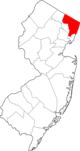
| المقاطعات |  | |
|---|---|---|
| المدينة الرئيسية | ||
| المدن والبلدات 100–999 ألف | ||
| المدن والبلدات 25–99 ألف | بايون • برانفورد • Cheshire • كلفتن • دانبري • إيست هاڤن • إيست اورانج • إنگلوود • فيرفيلد • گارفيلد • گرينتش • هاكنساك • هامدن • هوبوكن • هاول • كارني • لونگ بيتش • لونگ برانش • مريدن • مدلتاون • ملفورد • ماونت ڤرنون • نوگاتك • نيو برنزويك • نيو ملفورد • نيو روشل • نيوبرگ • نيوتن • نورواك • پاسيك • پرث أمبوي • پلينفيلد • پوكپسي • راوِيْ • شلتن • ستراتفورد • Torrington • ترنتون • ترمبول • يونيون سيتي • Wallingford • وست هيڤن • وستفيلد • وستپورت • هوايت پلينز | |
| المدن والبلدات 10–25 ألف | أنسونيا • آسبري پارك • بيكن • بثل • بروكفيلد • دارين • دربي • دوڤر • گلفورد • گوتنبرگ • هاريسن (نيو جرزي) • هاريسن (نيويورك) • كنگستن • ليندن • ماديسون • منرو • موريستاون • نيو كينن • New Fairfield • North Branford • North Haven • اورانج • پليموث • پيكسكيل • Ridgefield • راي • سكارسديل • سكوكس • سيمور • ساوثبري • سمت • واترتاون • وست نيويورك • وستن • ولتن • ونشستر • وولكت | |
| المناطق الفرعية | ||
- Pages using gadget WikiMiniAtlas
- Articles with dead external links from December 2025
- CS1 errors: markup
- Webarchive template archiveis links
- CS1 errors: unsupported parameter
- Short description is different from Wikidata
- Coordinates on Wikidata
- Pages using infobox settlement with deprecated parameters
- مقاطعات نيوجرزي
- Pages using infobox U.S. county with unknown parameters
- Articles with hatnote templates targeting a nonexistent page
- Articles with unsourced statements from August 2012
- Pages with empty portal template
- Counties in the New York metropolitan area
- شمال جرزي
- أماكن مأهولة تأسست في 1683
- مقاطعةبرگن، نيوجرزي
- تأسيسات 1683
- أسماء أماكن من أصل هولندي في الولايات المتحدة
- صفحات مع الخرائط