دومفريز وگالواي
Dumfries and Galloway Dumfries an Gallowa Dùn Phris is Gall-Ghaidhealaibh | |
|---|---|
 | |
 الدرع  Council logo | |
 Interactive map of Dumfries and Galloway Dumfries an Gallowa Dùn Phris is Gall-Ghaidhealaibh | |
| Sovereign state | United Kingdom |
| Country | Scotland |
| Lieutenancy areas | Dumfries Stewartry of Kirkcudbright Wigtown |
| Admin HQ | County Buildings, English Street, Dumfries |
| الحكومة | |
| • Leader | Gail MacGregor (Cons) |
| ترتيب المساحة | Ranked |
| • الترتيب | Ranked |
| ONS code | S12000006 |
| رمز ISO 3166 | GB-DGY |

دومفريز وگالواي Dumfries and Galloway غالية اسكتلندية: Dùn Phrìs is Gall-Ghaidhealaibh)، هي إحدى مناطق المجالس الموحدة في اسكتلندا وتقع غرب الأراضي المرتفعة الجنوبية. وتضم المقاطعات التاريخية دوفريزشاير، كيركودبرايتشاير ووايتاونشاير، والأخريتين المعروفتين باسم گالواي. المركز المحلي يقع هو بلدة دمفريز.
الجغرافيا
نظام المياه وطرق النقل في الأراضي المرتفعة الجنوبية
مناطق المناظر الطبيعية الوطنية
الحكومة وأسماء الأماكن
النقل
السكك الحديدية

الحافلات والعربات
النقل البحري

النقل الجوي
الطرق
خدمات الطوارئ
التعليم

الحياة البرية

أنشطة في الهوائ الطلق
العمارة والفنون
القرى والبلدات
أشهر الأماكن
التشكيل السياسي بالمجلس
2003–2007
| الحزب | الممثلون | |
| العمل | 14 | |
| مستقلون | 12 | |
| المحافظون | 11 | |
| الحزب الوطني الاسكتلندي | 5 | |
| الديمقراطيون الليبراليون | 5 |
2007–2011
| الحزب | الممثلون | |
| المحافظون | 18 | |
| العمل | 14 | |
| الحزب الوطني الاسكتلندي | 10 | |
| الديمقراطيون الليبراليون | 3 | |
| مستقلون | 2 |
2012–2017
| الحزب | الممثلون | |
| المحافظون | 15 | |
| العمل | 14 | |
| الحزب الوطني الاسكتلندي | 10 | |
| الديمقراطيون الليبراليون | 1 | |
| مستقلون | 7 |
انظر أيضاً
معرض الصور
-
 Dalveen Pass from Comb Head summit, near Thornhill, Dumfries and Galloway, Scotland.
 -
Lowther Hill, somewhere near Dalveen Pass, Dumfries and Galloway, Scotland.
-
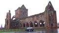 Sweetheart Abbey, Dumfries and Galloway (Scotland)
 -
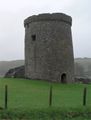 Orchardton Tower, Dumfries and Galloway, Scotland
 -
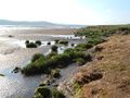 Caerlaverock National Nature Reserve. View across the Nith Estuary, close to the Solway Firth, Dumfries & Galloway.
 -
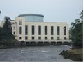 Tongland Power station.
 -
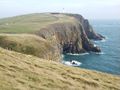 Mull of Galloway headland.
 -
 Mull of Galloway Lighthouse.
 -
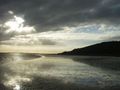 A Machars beach.
 -
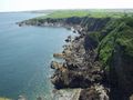 Machars Coastline looking south from Cruggleton Castle.
 -
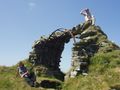 The remains of Cruggleton Castle.
 -
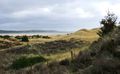 The Machars, as viewed from Torrs Warren with Luce Bay standing between.
 -
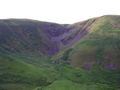 The Devil's Beef Tub.
 -
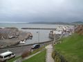 Port William harbour.
 -
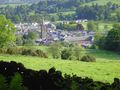 Moffat.
 -
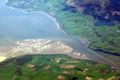 River Nith Estuary.


.JPG&filetimestamp=20130723224722&)


المصادر
وصلات خارجية
الكلمات الدالة:
تصنيفات:
- Pages using gadget WikiMiniAtlas
- Articles with hatnote templates targeting a nonexistent page
- Short description is different from Wikidata
- Pages using infobox settlement with no map
- Pages using infobox settlement with deprecated parameters
- Articles containing غالية اسكتلندية-language text
- Pages using Lang-xx templates
- دومفريز وگالواي
- مناطق اسكتلندا
- مناطق مجالس اسكتلندا
- تأسيسات 1975 في اسكتلندا
- صفحات مع الخرائط