مقاطعة أولان
أولان
Ұлан ауданы Ulan District | |
|---|---|
District | |
| Ұлан ауданы | |
 | |
 مقاطعة أولان، ضمن منطقة شرق قزخستان | |
| Country |  كازاخستان كازاخستان |
| Region | East Kazakhstan Region |
| Administrative center | Molodyozhny |
| Founded | 1928 |
| المساحة | |
• الإجمالي | 9٬160 كم² (3٬540 ميل²) |
| التعداد (2013)[1] | |
• الإجمالي | 40٬482 |
| منطقة التوقيت | UTC+6 (East) |
Ulan (بالقزخية: Ұлан ауданы, Ūlan audany) is a district of East Kazakhstan Region in eastern Kazakhstan. The administrative center of the district is the settlement of Molodyozhny.[2] Population: 40٬482 (تقدير 2013);[1] 39,079 (نتائج تعداد 2009);[3] 45,699 (نتائج تعداد 1999).[3]
التاريخ
The Ulansky district was formed on January 17, 1928 from the Leninskaya, Tarkhanskaya, Ulanskaya and part of the Proletarian volost of the Ust-Kamenogorsk district with the center in the village of Sibinsky (Approved by the All-Russian Central Executive Committee on September 3, 1928) [8] . On February 24, 1935, the center of the district was transferred from the village of Sibinsky to the village of Nikitinka [9] .
On January 2, 1963, the district was abolished, and its territory was divided between the Tauride District and the Serebryansky City Council . On January 31, 1966, the Ulansky district with the center in the village of Nikitinka (now the village of Bozanbay ) was restored [3] .
On May 23, 1997, the territory of the abolished Tavrichesky district was transferred to the district, the center of the district was transferred to the village of Molodyozhny (since 2011 - the village of Kasym Kaisenov ).
المعالم
The State Natural Monument "Sinegorsk Fir Grove" is a specially protected natural area of republican significance. It was formed in 1968 to protect the relic habitat of Siberian fir , the only one on the left bank of the Irtysh and which is a residual element of dark coniferous pine forests that previously covered the entire Kalbinsky Range. In 1982, the area of the monument was expanded from 90 to 137 hectares, of which the grove itself, located on the northern slope of Mount Medvedka in the Koktau mountain range, occupies 97 hectares [12] .
Akbaur is a cave temple complex of the Neolithic and Bronze Age , which served as a place of sacrifices and rituals. It is located 3 km north of the village of Besterek , on the slope of Mount Akbaur. The cone-shaped grotto is located at a height of 5-6 m from the foot of the mountain. There are rock paintings depicting a two-wheeled cart, a bull, a mountain goat, people and dwellings. The drawings are made in brown ocher and date back to the beginning of the 3rd millennium BC. e. [thirteen]
Ablaiket - the ruins of the Dzungarian fortified lamaist monastery. It is located 15 km from the village of Bozanbay , in the valley of the Ablaketka River. It was founded in 1654 by taishi Ablai . In 1671, during the internecine war, Galdan-Boshogtu was taken and plundered
السكان
National composition (at the beginning of 2019 ):
Kazakhs - 28,241 people. (72.08%) Russians - 9,932 people. (25.35%) Germans - 334 people. (0.85%) Tatars - 192 people. (0.49%) Ukrainians - 124 people. (0.32%) Chechens - 84 people. (0.21%) Uzbeks - 70 people. (0.18%) Belarusians - 37 people. (0.09%) others - 164 people. (0.42%) Total - 39 178 people. (100.00%)
الاقتصاد
التعدين
- رواسب أوگنيڤكا تا، أولان، شرق قزخستان.
-
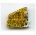 ثوروليت Thoreaulite: (Sn2+, Pb)(Ta,Nb)2O6, ليثيوتانيت Lithiotanite: LiTa3O8, رانكامايت Rankamaite: (Na,K)3(Ta,Nb,Al)11(o,OH)31, كاسيتريت Cassiterite: SnO2، آلبيت Albite: NaAlSi 3O 8.
 -
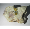 ثوروليت Thoreaulite: (Sn2+, Pb)(Ta,Nb)2O6, كاسيتريت Cassiterite: SnO2، لپيدوليت Lepidolite: K(Li,Al)
3(Al,Si,Rb)
4O
10(F,OH)
2، آلبيت Albite: NaAlSi 3O 8 ، كوارتز: SiO2 . -
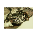 ودجنيت Wodginite: Mn2+(Sn,Ta)Ta
2O
8.
(Ta,Nb)2O6,_Lithiotanite_LiTa3O8,_Rankamaite_(Na,K)3(Ta,Nb,Al)11(o,OH)31,_Cassiterite_SnO2,_Albite_Na(AlSi3O8)_-_Ognevka_Ta_deposit,_Ulan,_East_Kazakhstan.png&filetimestamp=20220409160953&)
(Ta,Nb)2O6,_Cassiterite_SnO2,_Lepidolite,_Albite_(Na(AlSi3O8),_Quartz_SiO2_-_Ognevka_Ta_deposit,_Ulan,_East_Kazakhstan.png&filetimestamp=20220409160516&)

المراجع
- ^ أ ب "Население Республики Казахстан" (in الروسية). Департамент социальной и демографической статистики. Retrieved 27 December 2013.
- ^ www.geonames.de Subdivisions of Kazakhstan in local languages
- ^ أ ب "Население Республики Казахстан" (in Russian). Департамент социальной и демографической статистики. Retrieved 8 December 2013.
{{cite web}}: CS1 maint: unrecognized language (link) - ^ mindat. "Wodginite". mindat.org.
العاصمة: أوسكمن | ||
| المقاطعات |  | |
| مدن خاضعة للإقليم | ||
| المدن الرئيسية | ||
| مواقع الاختبارات النووية | ||
49°52′37″N 82°29′04″E / 49.87694°N 82.48444°E

- CS1 الروسية-language sources (ru)
- Pages using gadget WikiMiniAtlas
- Short description is different from Wikidata
- Pages using infobox settlement with no coordinates
- Pages using infobox settlement with deprecated parameters
- Articles containing قزخ-language text
- Coordinates on Wikidata
- Districts of Kazakhstan
- منطقة شرق قزخستان