مقاطعة بسكارا
Province of Pescara
| |
|---|---|
 Palazzo del Governo, the provincial seat at Pescara | |
 Flag | |
| Motto: | |
 Map highlighting the location of the province of Pescara in Italy | |
| Country |  إيطاليا إيطاليا |
| Region |  أبروتسو أبروتسو |
| Capital | Pescara |
| Municipalities | 46 |
| الحكومة | |
| • President | Giorgio De Luca[1] |
| المساحة | |
• الإجمالي | 1٬230٫33 كم² (475٫03 ميل²) |
| التعداد | |
• الإجمالي | 311٬563 |
| • الكثافة | 250/km2 (660/sq mi) |
| GDP | |
| • Total | €7.764 billion (2015) |
| • Per capita | €24,084 (2015) |
| منطقة التوقيت | UTC+1 (CET) |
| • الصيف (التوقيت الصيفي) | UTC+2 (CEST) |
| Postal code | 65010-65014, 65016-65017, 65019-65020, 65022-65024, 65026-65029 |
| Telephone prefix | 085 |
| لوحة السيارة | PE |
| ISTAT | 068 |
| الموقع الإلكتروني | Official website |
مقاطعة بسكارا Provincia di Pescara ، مقاطعة جنوب وسط إيطاليا في إقليم أبروتسو ، و عاصمتها هي مدينة بسكارا . و يبلغ مجموع سكانها 310.863 وتبلغ مساحتها 1224 كيلومتر مربع وبها 46 من مدينة وبلدة وقرية . تطل على البحر الأدرياتي من جهة الشمال الشرقي. تحدها من جهة الشمال مقاطعة تيرامو ومن الشرق مقاطعة كييتي ومن الجنوب الغربي مقاطعة لاكويلا .
History
Pescara's first indicators of settlement date to 1500 BCE, but it is unknown which tribe first settled in the city.[6] It was conquered by the Romans in 214 BCE and remained "Aternum" after the city allied itself with Punic Carthaginian military commander Hannibal. The Romans developed the city and it became an important location for shipping and trade occurring between the Balkans and Rome; the Romans made the city of Pescara the capital of the Valeria region. During the barbarian raids it was almost completely destroyed, and it developed into a fishing village named Piscaria.[6]
Charles V, Holy Roman Emperor turned Piscaria into a military fort named Pescara during the sixteenth century, and Pescara survived a series of invasions from Turkish Muslims.[6] It was ruled by the Austrians for a short period of the 1700s before falling under the control of the House of Bourbon; the House of Bourbon made it a component of Abruzzo Citra. It joined the Kingdom of Italy in 1860 and was still mainly fortified and Pescara was made a new provincial capital in 1927. In World War II, 78% of the city was destroyed by bombers.[6]
Geography
The province of Pescara is the central of four provinces in the region of Abruzzo on the eastern coast of Italy. It is bounded to the northeast by the Adriatic Sea. The Province of Teramo lies to the north and the Province of L'Aquila to the west and south. To the south and east lies the Province of Chieti. The provincial capital is the city and port of Pescara, situated at the mouth of the Aterno-Pescara River.[7]
Municipalities
- أهم المدن بعد العاصمة بسكارا هي مدينة مونتيسلفانو ذات 45.324 ساكن .
- Abbateggio
- Alanno
- Bolognano
- Brittoli
- Bussi sul Tirino
- Cappelle sul Tavo
- Caramanico Terme
- Carpineto della Nora
- Castiglione a Casauria
- Catignano
- Cepagatti
- Città Sant'Angelo
- Civitaquana
- Civitella Casanova
- Collecorvino
- Corvara
- Cugnoli
- Elice
- Farindola
- Lettomanoppello
- Loreto Aprutino
- Manoppello
- Montebello di Bertona
- Montesilvano
- Moscufo
- Nocciano
- Penne
- Pescara
- Pescosansonesco
- Pianella
- Picciano
- Pietranico
- Popoli
- Roccamorice
- Rosciano
- Salle
- San Valentino in Abruzzo Citeriore
- Sant'Eufemia a Maiella
- Scafa
- Serramonacesca
- Spoltore
- Tocco da Casauria
- Torre de' Passeri
- Turrivalignani
- Vicoli
- Villa Celiera
Demographics
| السنة | تعداد | ±% |
|---|---|---|
| 1861 | 128٬409 | — |
| 1871 | 135٬391 | +5.4% |
| 1881 | 138٬005 | +1.9% |
| 1901 | 160٬986 | +16.7% |
| 1911 | 173٬042 | +7.5% |
| 1921 | 177٬383 | +2.5% |
| 1931 | 196٬431 | +10.7% |
| 1936 | 211٬561 | +7.7% |
| 1951 | 239٬817 | +13.4% |
| 1961 | 242٬958 | +1.3% |
| 1971 | 264٬981 | +9.1% |
| 1981 | 286٬240 | +8.0% |
| 1991 | 289٬534 | +1.2% |
| 2001 | 295٬481 | +2.1% |
| 2011 | 314٬661 | +6.5% |
| 2021 | 313٬631 | −0.3% |
| Source: ISTAT[8][9] | ||
As of 2026, the population is 311,563, of which 48.5% are male, and 51.5% are female. Minors make up 14.5% of the population, and seniors make up 25.7%.[10][11]
Immigration
As of 2025, of the known countries of birth of 303,976 residents, the most numerous are: Italy (279,609 – 92%), Romania (3,907 – 1.3%), Albania (2,252 – 0.7%).[12][13]
Main sights
Pescara

.jpg&filetimestamp=20260617023109&)
The city is divided in two by the river.
The historic city center is located on the south shore, where once stood the Piazzaforte (fortified town), a military bulwark of the Kingdom of the Two Sicilies. There is the Bagno Borbonico (the old prison of the Kingdom of the Two Sicilies, built starting in 1510 by order of Charles V, which incorporated inside the remains of the Norman and Byzantine city walls). Today it houses the Museum of the Abruzzi people:[14] the institution traces, towards 13 halls dedicated to the aspects of life, traditions and economy, 4,000 years of history of the Abruzzo people.
In the historic city center are the birthplace houses of Gabriele D'Annunzio[15] and Ennio Flaiano, and the San Cetteo Cathedral, build between 1933 and 1938.
On the north shore of the river there's Piazza Italia (Italy Square), overlooked by the City Hall and the Government Building (which houses the headquarters of the province of Pescara), both built during the Fascist era according to the fascist rationalist style and designed by the architect Vincenzo Pilotti. Pilotti designed the majority of the public buildings of the city, including the seat of the local Chamber of Commerce, of the Liceo Classico "G. D'Annunzio" high school,[16] and the old seat of the court (which now houses a museum).[17]
In the very south part of the city, between the D'Avalos Park and the beach, there is an elegant Art Nouveau villas district designed in 1912 by Antonino Liberi (an engineer brother-in-law of D'Annunzio). There is also the Aurum, first headquarters of a social club (called the Kursaal), then liquor factory, and today public multipurpose space.[18][19]
In 2007 was built the Ponte del Mare, the largest pedestrian and cycle bridge in Italy.
On the northern waterfront, close to the Salotto Square, the main square of the city, there is the Nave (trad. the ship), a sculpture by Pietro Cascella.
National Park of Majella
- Abbey of San Clemente (Castiglione a Casauria)
- Abbey of San Liberatore (Serramonacesca)
- Hermitage of Sant'Onofrio (Serramonacesca)
- Hermitage of Santo Spirito (Serramonacesca)
- Hermitage of San Bartolomeo (Roccamorice)
- Basilica of Holy Draw of Manoppello
- Historical center of Penne
- Historical center of Loreto Aprutino
- Historical center of Città Sant'Angelo
معرض الصور
-
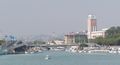 ميناء بسكارا و على اليمين برج البلدية
 -
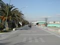 الريفييرا الشمالية - بسكارا
 -
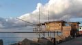 مصائد الترابوكو - بسكارا
 -
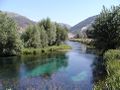 نهر بسكارا
 -
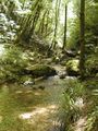 نهر أورفينتو


See also
المراجع
- ^ "Il Presidente - Antonio Zaffiri". Provincia di Pescara. Retrieved 23 November 2019.
- ^ "Superficie di Comuni Province e Regioni italiane al 9 ottobre 2011" (in الإيطالية). ISTAT.
- ^ "Resident population by age, sex and marital status on 1st January 2026". demo.istat.it. ISTAT. 2026-01-01. Retrieved 2026-04-01. (On the search form, choose the statistical region of the municipality in the Area section, the Region, the Province, and the name of the Municipality)
- ^ "Resident population by age, sex and marital status on 1st January 2026". demo.istat.it. ISTAT. 2026-01-01. Retrieved 2026-04-01.The file URL linking on technical dataset.
- ^ Regions and Cities > Regional Statistics > Regional Economy > Regional Gross Domestic Product (Small regions TL3), OECD.Stats. Accessed on 16 November 2018.
- ^ أ ب ت ث Roy Palmer Domenico (2002). The Regions of Italy: A Reference Guide to History and Culture. Greenwood Publishing Group. pp. 11–12. ISBN 978-0-313-30733-1.
- ^ The Times Comprehensive Atlas of the World (13 ed.). Times Books. 2011. p. 76. ISBN 9780007419135.
- ^ "Popolazione residente dei comuni. Censimenti dal 1861 al 1991" [Resident population of the municipalities. Censuses from 1861 to 1991] (PDF) (in الإيطالية). ISTAT. Archived from the original (PDF) on 2025-11-12.
- ^ "Resident population - Time series". ISTAT.
- ^ "Resident population by age, sex and marital status on 1st January 2026". demo.istat.it. ISTAT. 2026-01-01. Retrieved 2026-04-01. (On the search form, choose the statistical region of the municipality in the Area section, the Region, the Province, and the name of the Municipality)
- ^ "Resident population by age, sex and marital status on 1st January 2026". demo.istat.it. ISTAT. 2026-01-01. Retrieved 2026-04-01.The file URL linking on technical dataset.
- ^ "Resident population by sex, municipality and individual citizenship or country of birth from year 2002". demo.istat.it. ISTAT. 2025-01-01. Retrieved 2025-02-27. (Click on 'View by country of birth', and on the search form, choose the statistical region of the municipality in the Area section, the Region, the Province, and the name of the Municipality)
- ^ "Resident population by sex, municipality and individual citizenship or country of birth from year 2002". demo.istat.it. ISTAT. 2025-01-01. Retrieved 2025-02-27.The file URL linking on technical dataset.
- ^ "Museo delle Genti d'Abruzzo – Un viaggio nelle tradizioni e nella storia millenaria dell'Abruzzo".
- ^ "Pescara". Italia:The Official Tourism Website. Retrieved 26 January 2013.
- ^ "Storia del Liceo". www.liceoclassicope.gov.it. Retrieved 2016-02-14.
- ^ "Mediamuseum". www.mediamuseum.it. Retrieved 2016-02-14.
- ^ "Storia del rione pineta dannunziana: Il Kursaal - AURUM - La nostra Storia Pescara - Abruzzo24ore.tv". www.abruzzo24ore.tv. Retrieved 2016-02-14.
- ^ "Storia – Portfolio Categories – Aurum". aurum.comune.pescara.it. Retrieved 2016-02-14.
وصلات خارجية

- Provincia di Pescara homepage (in إيطالية)
| Provinces and geography |  | |
|---|---|---|
| History | ||
| Politics and government | ||
| Culture and heritage | ||
| Economy | ||
| Science | ||
| Education | ||
| Transport | ||
| International | |
|---|---|
| National | |


- CS1 الإيطالية-language sources (it)
- Pages using gadget WikiMiniAtlas
- Short description is different from Wikidata
- Articles containing إيطالية-language text
- Articles containing لاتينية-language text
- Pages using infobox settlement with no coordinates
- Pages using infobox settlement with deprecated parameters
- Articles with إيطالية-language sources (it)
- Coordinates on Wikidata
- Province of Pescara
- Provinces of Italy
- مقاطعات إيطاليا