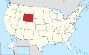
مقاطعة گوشن، وايومنگ
Goshen County | |
|---|---|
 | |
 الموقع ضمن ولاية Wyoming | |
 موقع Wyoming ضمن الولايات المتحدة | |
| الإحداثيات: 42°05′N 104°22′W / 42.09°N 104.36°W | |
| البلد | |
| State | |
| تأسست | 1913 |
| Seat | Torrington |
| أكبر مدينة | Torrington |
| المساحة | |
| • الإجمالي | 2٬232 ميل² (5٬780 كم²) |
| • البر | 2٬225 ميل² (5٬760 كم²) |
| • الماء | 6٫8 ميل² (18 كم²) 0.3%% |
| التعداد | |
| • Estimate (2016) | 13٬390 |
| • الكثافة | 6٫0/sq mi (2٫3/km2) |
| منطقة التوقيت | UTC−7 (Mountain) |
| • الصيف (التوقيت الصيفي) | UTC−6 (MDT) |
| Congressional district | At-large |
مقاطعة گوشن إنگليزية: Goshen County هي إحدى مقاطعات ولاية وايومنگ في الولايات المتحدة الأمريكية.
الجغرافيا
| بيانات المناخ لـ Torrington, Wyoming | |||||||||||||
|---|---|---|---|---|---|---|---|---|---|---|---|---|---|
| الشهر | ينا | فب | مار | أبر | ماي | يون | يول | أغس | سبت | أكت | نوف | ديس | السنة |
| القصوى القياسية °ف (°س) | 70 (21) |
75 (24) |
85 (29) |
91 (33) |
100 (38) |
105 (41) |
111 (44) |
105 (41) |
101 (38) |
92 (33) |
83 (28) |
77 (25) |
111 (44) |
| متوسط القصوى اليومية °ف (°س) | 39.5 (4.2) |
45.0 (7.2) |
52.0 (11.1) |
61.2 (16.2) |
71.0 (21.7) |
82.4 (28.0) |
89.1 (31.7) |
87.3 (30.7) |
77.7 (25.4) |
65.4 (18.6) |
49.2 (9.6) |
41.0 (5.0) |
63.4 (17.5) |
| المتوسط اليومي °ف (°س) | 24.9 (−3.9) |
30.0 (−1.1) |
37.5 (3.1) |
46.0 (7.8) |
56.2 (13.4) |
66.3 (19.1) |
72.3 (22.4) |
70.2 (21.2) |
59.8 (15.4) |
47.6 (8.7) |
34.0 (1.1) |
26.2 (−3.2) |
47.6 (8.7) |
| متوسط الدنيا اليومية °ف (°س) | 10.3 (−12.1) |
14.9 (−9.5) |
23.0 (−5.0) |
30.7 (−0.7) |
41.3 (5.2) |
50.2 (10.1) |
55.5 (13.1) |
53.1 (11.7) |
41.9 (5.5) |
29.7 (−1.3) |
18.8 (−7.3) |
11.3 (−11.5) |
31.7 (−0.2) |
| الصغرى القياسية °ف (°س) | −39 (−39) |
−33 (−36) |
−26 (−32) |
−17 (−27) |
11 (−12) |
29 (−2) |
39 (4) |
32 (0) |
14 (−10) |
−9 (−23) |
−23 (−31) |
−43 (−42) |
−43 (−42) |
| متوسط تساقط الأمطار inches (mm) | 0.31 (7.9) |
0.40 (10) |
0.70 (18) |
1.68 (43) |
2.54 (65) |
2.09 (53) |
1.78 (45) |
1.19 (30) |
1.27 (32) |
0.95 (24) |
0.57 (14) |
0.36 (9.1) |
13.84 (351) |
| متوسط هطول الثلج inches (cm) | 4.8 (12) |
4.9 (12) |
4.9 (12) |
3.2 (8.1) |
0.1 (0.25) |
0.0 (0.0) |
0.0 (0.0) |
0.0 (0.0) |
0.4 (1.0) |
2.1 (5.3) |
4.8 (12) |
6.8 (17) |
32 (79.65) |
| Average precipitation days (≥ 0.01 inch) | 4.3 | 3.5 | 5.3 | 7.5 | 9.8 | 8.7 | 7.6 | 6.3 | 5.9 | 4.7 | 4.0 | 3.9 | 71.5 |
| Source 1: NOAA (normals, 1971–2000) [1] | |||||||||||||
| Source 2: The Weather Channel (Records) [2] NOAA NNDC Climate Data [3] | |||||||||||||
In the late spring of 2009, a weather research team known as VORTEX2 observed the full life cycle of a tornado near the border with Nebraska in eastern Goshen County.
الديمغرافيا
| التعداد | Pop. | ملاحظة | %± |
|---|---|---|---|
| 1920 | 8٬064 | — | |
| 1930 | 11٬754 | 45٫8% | |
| 1940 | 12٬207 | 3٫9% | |
| 1950 | 12٬634 | 3٫5% | |
| 1960 | 11٬941 | −5٫5% | |
| 1970 | 10٬885 | −8٫8% | |
| 1980 | 12٬040 | 10٫6% | |
| 1990 | 12٬373 | 2٫8% | |
| 2000 | 12٬538 | 1٫3% | |
| 2010 | 13٬249 | 5٫7% | |
| 2016 (تق.) | 13٬390 | [4] | 1٫1% |
| U.S. Decennial Census[5] 1870–2000[6] 2010–2016[7] | |||
الانتخابات
Goshen County voters have been reliably Republican for several decades. Since 1936, in only one national election did they select the Democratic Party candidate (as of 2020).
Presidential elections results
| Year | Republican | Democratic | Third parties |
|---|---|---|---|
| 2020 | 78.2% 4,878 | 19.3% 1,203 | 2.6% 160 |
| 2016 | 76.2% 4,418 | 15.9% 924 | 7.8% 454 |
| 2012 | 72.0% 4,178 | 25.1% 1,458 | 2.9% 170 |
| 2008 | 66.7% 3,942 | 31.0% 1,832 | 2.3% 138 |
| 2004 | 71.2% 4,114 | 27.1% 1,566 | 1.7% 99 |
| 2000 | 71.1% 3,922 | 26.1% 1,439 | 2.9% 159 |
| 1996 | 54.2% 2,989 | 34.9% 1,923 | 10.9% 601 |
| 1992 | 45.0% 2,395 | 33.0% 1,754 | 22.0% 1,169 |
| 1988 | 61.4% 3,075 | 37.5% 1,875 | 1.1% 55 |
| 1984 | 72.8% 3,776 | 26.3% 1,364 | 0.9% 44 |
| 1980 | 67.2% 3,572 | 25.8% 1,373 | 7.0% 370 |
| 1976 | 54.9% 2,764 | 44.9% 2,262 | 0.2% 12 |
| 1972 | 70.3% 3,629 | 29.3% 1,515 | 0.4% 20 |
| 1968 | 57.7% 2,719 | 32.4% 1,529 | 9.9% 468 |
| 1964 | 48.7% 2,604 | 51.4% 2,749 | |
| 1960 | 56.8% 3,178 | 43.2% 2,414 | |
| 1956 | 57.0% 2,825 | 43.0% 2,130 | |
| 1952 | 67.1% 3,396 | 32.6% 1,648 | 0.3% 14 |
| 1948 | 51.9% 2,029 | 47.2% 1,843 | 1.0% 37 |
| 1944 | 63.9% 2,674 | 36.2% 1,514 | |
| 1940 | 58.9% 2,861 | 40.8% 1,982 | 0.3% 15 |
| 1936 | 43.1% 2,047 | 55.6% 2,639 | 1.4% 65 |
| 1932 | 42.6% 1,954 | 55.5% 2,545 | 2.0% 91 |
| 1928 | 75.3% 2,483 | 23.6% 777 | 1.2% 38 |
| 1924 | 56.2% 1,603 | 16.3% 464 | 27.6% 788 |
| 1920 | 72.7% 1,496 | 26.8% 552 | 0.4% 9 |
| 1916 | 39.8% 770 | 56.6% 1,096 | 3.6% 70 |
| 1912 | 32.5% 292 | 35.4% 318 | 32.1% 288 |
Transportation
Highways
U.S. Highways
- Invalid type: US
- Invalid type: US
State Routes
- Invalid type: WY (Huntley Road)
- Invalid type: WY (LaGrange Road)
- Invalid type: WY (Yoder Road)
- Invalid type: WY (Springer Reservoir Road)
- Invalid type: WY (Veteran Road)
- Invalid type: WY (Sugar Factory Road)
- Invalid type: WY (Horse Creek Road)
- Invalid type: WY (Van Tassell Road)
- Invalid type: WY (Old Fort Laramie Road)
- Invalid type: WY (Yoder-Huntley Road)
- Invalid type: WY (Chugwater Road)
Airport
انظر أيضاً
وصلات خارجية
الهامش
- ^ "Climatography of the United States NO.81" (PDF). National Oceanic and Atmospheric Administration. Retrieved January 13, 2011.
- ^ "Monthly Averages for Torrington, WY". The Weather Channel. Retrieved January 13, 2011.
- ^ "Climate Data Online Extremes Products". National Oceanic and Atmospheric Administration. Retrieved June 3, 2012.
- ^ "Population and Housing Unit Estimates". Retrieved June 9, 2017.
- ^ "U.S. Decennial Census". United States Census Bureau. Archived from the original on May 12, 2015. Retrieved August 5, 2015.
{{cite web}}: Unknown parameter|deadurl=ignored (|url-status=suggested) (help) - ^ "Historical Decennial Census Population for Wyoming Counties, Cities, and Towns". Wyoming Department of Administration & Information, Division of Economic Analysis. Retrieved January 25, 2014.
- ^ خطأ استشهاد: وسم
<ref>غير صحيح؛ لا نص تم توفيره للمراجع المسماةQF - ^ Leip, David. "Atlas of US Presidential Elections". uselectionatlas.org. Retrieved April 5, 2018.
- ^ "Goshen County Public and Private Airports". www.tollfreeairline.com. Retrieved April 5, 2018.

|
مقاطعة نيوبرارا | 
| ||
| مقاطعة سكوتس بلف، نبراسكا و مقاطعة سو، نبراسكا | مقاطعة پلات | |||
| مقاطعة بانر، نبراسكا | مقاطعة لارامي |
?
تصنيفات:
- Pages using gadget WikiMiniAtlas
- CS1 errors: unsupported parameter
- Short description is different from Wikidata
- Coordinates on Wikidata
- مقاطعات Wyoming
- Articles containing إنگليزية-language text
- Pages using Lang-xx templates
- Pages using US Census population needing update
- Jct template errors
- مقاطعة گوشن، وايومنگ
- تأسيسات 1913 في وايومنگ
- أماكن مأهولة تأسست في 1913
- مقاطعات وايومنگ

