آرتشز، المنتزه الوطني
| منتزه الأقواس الوطني | |
|---|---|
IUCN category II (national park) | |
 قوس دليكيت وخلفه جبال لا سال | |
 Interactive map of منتزه الأقواس الوطني | |
| الموقع | مقاطعة غراند، يوتا، الولايات المتحدة |
| أقرب مدينة | موآب، يوتا |
| الإحداثيات | 38°43′41″N 109°32′24″W / 38.72806°N 109.54000°W |
| المساحة | 76،679 acre (119.811 sq mi; 31،031 ha; 310.31 km2)[1] |
| تأسست | أبريل 12, 1929، بوصفه نصبًا وطنيًا؛ نوفمبر 12, 1971، بوصفه منتزهًا وطنيًا |
| الزوار | 1,460,652 (in 2022)[2] |
| الهيئة الحاكمة | دائرة المنتزهات الوطنية |
| الموقع الإلكتروني | nps |

منتزه الأقواس الوطني هو منتزه وطني أمريكي يقع في شرق يوتا. ويجاور المنتزه نهر كولورادو، ويقع على بعد 4 mi (6 km) شمال موآب، يوتا. ويضم المنتزه أكثر من 2,000 قوس طبيعي من الحجر الرملي، من بينها قوس دليكيت الشهير، التي تمثل أعلى كثافة من الأقواس الطبيعية في العالم. كما يضم مجموعة متنوعة من الموارد والتكوينات الجيولوجية الفريدة الأخرى.[3][4] ويقع المنتزه الوطني فوق طبقة جوفية من المتبخرات أو الملح، وهي السبب الرئيسي في تشكل الأقواس والقمم الصخرية والصخور المتوازنة والحجر الرملي ذي الزعانف الصخرية والأعمدة الصخرية المتآكلة في المنطقة.
يمتد المنتزه على مساحة 310.31 km2 (76،680 acre; 119.81 sq mi) من الصحراء المرتفعة الواقعة على هضبة كولورادو.[5] ويبلغ أعلى ارتفاع في المنتزه 5،653 ft (1،723 m) عند بوت إلفانت، في حين يبلغ أدنى ارتفاع 4،085 ft (1،245 m) عند مركز الزوار. ويتلقى المنتزه في المتوسط أقل من 10 in (250 mm) من الأمطار سنويًا.
وتدير دائرة المنتزهات الوطنية المنطقة، التي صُنفت في الأصل نصبًا وطنيًا في 12 أبريل 1929، قبل إعادة تصنيفها منتزهًا وطنيًا في 12 نوفمبر 1971.[6] واستقبل المنتزه أكثر من 1.8 مليون زائر في عام 2021.[2] وقد انخفض هذا العدد في السنوات الأخيرة، إذ بلغ عدد الزوار في عام 2024 أقل بقليل من 1.5 مليون زائر.[7]
الغرض من المنتزه
كما ورد في الوثيقة التأسيسية المنشورة على موقع دائرة المنتزهات الوطنية الأمريكية:[8]
الغرض من منتزه الأقواس الوطني هو حماية نماذج استثنائية من المعالم الجيولوجية، بما في ذلك الأقواس والجسور الطبيعية والنوافذ والقمم الصخرية والصخور المتوازنة، فضلًا عن المعالم الأخرى ذات الأهمية الجيولوجية والتاريخية والعلمية، وإتاحة الفرص لاختبار هذه الموارد وقيمها المرتبطة بها في بيئاتها الطبيعية المهيبة.
الجيولوجيا

يقع المنتزه الوطني فوق طبقة جوفية من المتبخرات أو الملح، وهي السبب الرئيسي في تشكل الأقواس والقمم الصخرية والصخور المتوازنة والحجر الرملي ذي الزعانف الصخرية والأعمدة الصخرية المتآكلة في المنطقة. ويبلغ سمك طبقة الملح هذه آلاف الأقدام في بعض المواضع، وقد ترسبت في حوض بارادوكس على هضبة كولورادو قبل نحو 300 مليون سنة، عندما غمر بحر المنطقة ثم تبخر في نهاية المطاف. وعلى مدى ملايين السنين، غُطيت طبقة الملح برواسب حملتها عوامل التعرية من مرتفَع أونكومباهغر إلى الشمال الشرقي. وخلال العصر الجوراسي المبكر (قبل نحو 200 مليون سنة)، سادت الظروف الصحراوية في المنطقة، وترسبت طبقة حجر نافاهو الرملي الشاسعة. ثم ترسبت فوق حجر نافاهو الرملي طبقة أخرى من الرواسب التي حملتها المجاري المائية والرياح، وهي حجر إنتادا الرملي (قبل نحو 140 مليون سنة). وترسبت فوقها أكثر من 5,000 قدم (1,500 م) من الرواسب الأحدث، وقد تعرض معظمها للتعرية. ولا تزال بقايا الغطاء الرسوبي موجودة في المنطقة، بما في ذلك مكاشف الطباشيري من طفل مانكوس. وتتكون أقواس المنطقة في معظمها داخل تكوين إنتادا.[9] أدى وزن هذا الغطاء إلى تسييل طبقة الملح الواقعة تحته ودفع طبقات الصخور إلى أعلى لتكوين قباب ملحية. وشكلت المتبخرات في المنطقة «طيات محدبة ملحية» أكثر غرابة، أو مناطق خطية من الارتفاع.[9] وحدث تصدع، وهبطت مقاطع كاملة من الصخور في المناطق الواقعة بين القباب. وفي بعض المواضع، مالت هذه الصخور حتى أصبحت شبه عمودية. ويمكن رؤية نتيجة إحدى عمليات الإزاحة هذه، التي بلغت 2،500 ft (760 m)، وهي صدع موآب، من مركز الزوار.

ومع تشكل المشهد الطبيعي بفعل حركة الملح الجوفية، أزالت التعرية طبقات الصخور الأحدث من السطح. وباستثناء بقايا معزولة، فإن التكوينات الرئيسية الظاهرة اليوم في المنتزه هي حجر إنتادا الرملي ذو اللون السلموني، الذي تتشكل فيه معظم الأقواس، وحجر نافاهو الرملي ذو اللون البني الفاتح. وتظهر هذه الطبقات على هيئة طبقات متعاقبة تشبه قالب الحلوى في معظم أنحاء المنتزه. ومع مرور الزمن، تسربت المياه إلى الشقوق والفواصل والطيات السطحية لهذه الطبقات. وتشكل الجليد في الشقوق، فتمدد وضغط على الصخور المحيطة، مما أدى إلى انفصال أجزاء وقطع منها. ثم أزالت الرياح الجزيئات المفككة. وبقيت مجموعة من الزعانف الصخرية القائمة بذاتها. وواصلت الرياح والمياه مهاجمة هذه الزعانف حتى فقدت، في بعضها، المادة اللاحمة، فتساقطت منها كتل صخرية. وانهارت كثير من الزعانف المتضررة. أما الزعانف الأخرى، التي تمتعت بالدرجة المناسبة من الصلابة والتوازن، فقد صمدت رغم فقدان أجزاء منها. وتحولت هذه إلى الأقواس الشهيرة.

على الرغم من أن تضاريس المنتزه قد تبدو وعرة ومتينة، فإنها شديدة الهشاشة. ويهدد أكثر من مليون زائر سنويًا النظام البيئي الهش للصحراء المرتفعة.[10] وتكمن المشكلة في قشرة التربة، التي تتكون من البكتيريا الزرقاء والطحالب والفطريات والأشنات التي تنمو في الأجزاء المغبرة من المنتزه. ومن العوامل التي تجعل منتزه الأقواس الوطني حساسًا للأضرار التي يسببها الزوار كونه منطقة شبه قاحلة، وندرة هطول الأمطار وعدم انتظامه، وندرة التجمد العميق، وغياب المخلفات النباتية، مما يؤدي إلى تربة ذات مقاومة منخفضة لقوى الضغط، مثل حركة الأقدام، وبطيئة التعافي منها. وتشمل طرق تحديد آثار ذلك في التربة مؤشر قشرة التربة السيتوفوبية، وقياس تسرب المياه، واختبارات t المستخدمة لمقارنة القيم بين المناطق غير المضطربة والمناطق المضطربة.[11]
تشكل الأقواس

.jpg&filetimestamp=20260822135422&)
أدت العمليات الجيولوجية التي حدثت قبل أكثر من 300 مليون سنة إلى ترسب طبقة ملحية تقع اليوم أسفل مشهد منتزه الأقواس الوطني.[12] ومع مرور الزمن، غُطيت طبقة الملح بالرواسب التي انضغطت في نهاية المطاف لتتحول إلى طبقات صخرية عُرفت لاحقًا باسم حجر إنتادا الرملي. واستمرت طبقات الصخور المحيطة بحافة طبقة الملح في التآكل والتحرك لتتحول إلى جدران عمودية من الحجر الرملي تُسمى الزعانف الصخرية. وتراكم الرمل بين الجدران العمودية للزعانف، ثم أتاحت الأمطار الحمضية قليلًا، بالاقتران مع ثنائي أكسيد الكربون الموجود في الهواء، تكوين حمض الكربونيك كيميائيًا داخل الرمال المحصورة. ومع مرور الوقت، أذاب حمض الكربونيك كربونات الكالسيوم التي كانت تربط الحجر الرملي ببعضه.[13] وتحتوي كثير من التكوينات الصخرية على طبقات أضعف في الأسفل تحمل طبقات أقوى فوقها. وكانت الطبقات الأضعف تذوب أولًا، مكونةً فتحات في الصخور. وأدت الجاذبية إلى سقوط أجزاء من الطبقة الصخرية الأقوى تدريجيًا، لتتشكل في هيئة قوس. وتتكون الأقواس داخل الزعانف الصخرية عند نقاط تركز التشققات الشديدة، أو عند نقاط الضعف في تكوين الصخور، التي تسببها الانقطاعات الأفقية والرأسية.[14] وأخيرًا، واصلت المياه والرياح والزمن عملية التعرية هذه، وأدت في نهاية المطاف إلى تشكل أقواس منتزه الأقواس الوطني.[13] وجميع الأقواس في المنتزه مكونة من حجر إنتادا الرملي، إلا أن هناك اختلافات طفيفة في كيفية تشكل كل قوس. ويُصنف حجر إنتادا الرملي إلى ثلاث مجموعات: أعضاء سليك روك، وأعضاء ديوي روك، وأعضاء موآب.[15] ويمكن أن تتشكل الأقواس العمودية من أعضاء سليك روك، أو من مزيج من أعضاء سليك روك وأعضاء موآب، أو من أعضاء سليك روك المستقرة فوق أعضاء ديوي روك. أما الأقواس الأفقية، التي تُسمى أيضًا حفرًا، فتتشكل عندما تلتقي حفرة عمودية بتكوين مع كهف أفقي، مما يؤدي إلى اتصال يشكل بنية قوسية طويلة. وستستمر عملية التعرية في منتزه الأقواس الوطني مع مرور الزمن. وستؤدي التعرية المستمرة، مقترنة بالإجهاد الرأسي والأفقي، في نهاية المطاف إلى انهيار الأقواس، إلا أن أقواس جديدة ستستمر في التشكل لآلاف السنين.[16]
Climate
According to the Köppen climate classification system, Arches Visitor Center has a cold semi-arid climate (BSk).
| بيانات المناخ لـ Arches National Park Headquarters, Utah, 1991–2020 normals, extremes 1980–present | |||||||||||||
|---|---|---|---|---|---|---|---|---|---|---|---|---|---|
| الشهر | ينا | فب | مار | أبر | ماي | يون | يول | أغس | سبت | أكت | نوف | ديس | السنة |
| القصوى القياسية °ف (°س) | 63 (17) |
74 (23) |
87 (31) |
93 (34) |
105 (41) |
110 (43) |
116 (47) |
109 (43) |
105 (41) |
95 (35) |
79 (26) |
69 (21) |
116 (47) |
| متوسط القصوى اليومية °ف (°س) | 41.5 (5.3) |
50.0 (10.0) |
62.1 (16.7) |
69.6 (20.9) |
80.1 (26.7) |
92.5 (33.6) |
98.7 (37.1) |
95.8 (35.4) |
87.1 (30.6) |
72.1 (22.3) |
55.9 (13.3) |
41.9 (5.5) |
70.6 (21.4) |
| المتوسط اليومي °ف (°س) | 31.9 (−0.1) |
39.6 (4.2) |
49.5 (9.7) |
56.7 (13.7) |
66.6 (19.2) |
77.8 (25.4) |
84.5 (29.2) |
81.9 (27.7) |
72.7 (22.6) |
58.1 (14.5) |
44.3 (6.8) |
32.9 (0.5) |
58.0 (14.4) |
| متوسط الدنيا اليومية °ف (°س) | 22.3 (−5.4) |
29.1 (−1.6) |
36.9 (2.7) |
43.7 (6.5) |
53.0 (11.7) |
63.0 (17.2) |
70.3 (21.3) |
67.9 (19.9) |
58.3 (14.6) |
44.2 (6.8) |
32.6 (0.3) |
23.9 (−4.5) |
45.4 (7.4) |
| متوسط الدنيا °ف (°س) | 10.7 (−11.8) |
16.8 (−8.4) |
24.8 (−4.0) |
30.6 (−0.8) |
39.1 (3.9) |
49.1 (9.5) |
58.2 (14.6) |
57.8 (14.3) |
43.1 (6.2) |
29.1 (−1.6) |
18.8 (−7.3) |
10.7 (−11.8) |
7.4 (−13.7) |
| الصغرى القياسية °ف (°س) | −4 (−20) |
−8 (−22) |
13 (−11) |
21 (−6) |
28 (−2) |
37 (3) |
50 (10) |
44 (7) |
26 (−3) |
16 (−9) |
10 (−12) |
−4 (−20) |
−8 (−22) |
| متوسط تساقط الأمطار inches (mm) | 0.55 (14) |
0.56 (14) |
0.65 (17) |
0.71 (18) |
0.75 (19) |
0.43 (11) |
0.73 (19) |
0.90 (23) |
0.88 (22) |
1.12 (28) |
0.56 (14) |
0.61 (15) |
8.45 (215) |
| متوسط هطول الثلج inches (cm) | 2.1 (5.3) |
1.2 (3.0) |
0.5 (1.3) |
0.0 (0.0) |
0.0 (0.0) |
0.0 (0.0) |
0.0 (0.0) |
0.0 (0.0) |
0.0 (0.0) |
0.1 (0.25) |
0.7 (1.8) |
3.5 (8.9) |
8.1 (21) |
| Average precipitation days (≥ 0.01 in) | 4.2 | 4.5 | 4.9 | 5.0 | 4.8 | 2.4 | 4.7 | 6.0 | 4.9 | 5.5 | 4.1 | 3.8 | 54.8 |
| Source: NOAA[17][18] | |||||||||||||
| Mean daily daylight hours for Arches National Park | |||||||||||||
|---|---|---|---|---|---|---|---|---|---|---|---|---|---|
| Month | Jan | Feb | Mar | Apr | May | Jun | Jul | Aug | Sep | Oct | Nov | Dec | Year |
| Mean daily daylight hours | 10.0 | 10.5 | 12.0 | 13.0 | 14.0 | 15.0 | 14.5 | 13.5 | 12.5 | 11.5 | 10.0 | 9.5 | 12.2 |
| Source: Weather Atlas[19] | |||||||||||||
Plants and animals

An abundance of wildlife occurs in Arches National Park, including spadefoot toads, antelope squirrels, scrub jays, peregrine falcons, many kinds of sparrows, red foxes, desert bighorn sheep, kangaroo rats, mule deers, cougars, midget faded rattlesnakes, yucca moths, western rattlesnakes, and collared lizards.[20]
A number of plant species are common in the park, including prickly pear cactus, Indian ricegrass, bunch grasses, cheatgrass, moss, liverworts, Utah juniper, Mormon tea, blackbrush, cliffrose, four-winged saltbrush, pinyon pine, evening primrose, sand verbena, yucca, and sacred datura.[21]
Biological soil crust consisting of cyanobacteria, lichen, mosses, green algae, and microfungi is found throughout southeastern Utah. The fibrous growths help keep soil particles together, creating a layer that is more resistant to erosion. The living soil layer readily absorbs and stores water, allowing more complex forms of plant life to grow in places with low precipitation levels.[22]
History

Humans have occupied the region since the last ice age 10,000 years ago. Fremont people and Ancestral Puebloans lived in the area until about 700 years ago. Spanish missionaries encountered Ute and Paiute tribes in the area when they first came through in 1775, but the first European-Americans to attempt settlement in the area were the Mormon Elk Mountain Mission in 1855, who soon abandoned the area. Ranchers, farmers, and prospectors later settled Moab in the neighboring Riverine Valley in the late 1870s. Word of the beauty of the surrounding rock formations spread beyond the settlement as a possible tourist destination.
The Arches area was first brought to the attention of the National Park Service by Frank A. Wadleigh, passenger traffic manager of the Denver and Rio Grande Western Railroad. Wadleigh, accompanied by railroad photographer George L. Beam, visited the area in September 1923 at the invitation of Alexander Ringhoffer, a Hungarian-born prospector living in Salt Valley. Ringhoffer had written to the railroad to interest them in the tourist potential of a scenic area he had discovered the previous year with his two sons and a son-in-law, which he called the Devils Garden (known today as the Klondike Bluffs). Wadleigh was impressed by what Ringhoffer showed him, and suggested to Park Service director Stephen T. Mather that the area be made a national monument.
The following year, additional support for the monument idea came from Laurence Gould, a University of Michigan graduate student (and future polar explorer) studying the geology of the nearby La Sal Mountains, who was shown the scenic area by local physician Dr. J. W. "Doc" Williams.

A succession of government investigators examined the area, in part due to confusion as to the precise location. In the process, the name Devils Garden was transposed to an area on the opposite side of Salt Valley that includes Landscape Arch, the longest arch in the park. Ringhoffer's original discovery was omitted, while another area nearby, known locally as the Windows, was included. Designation of the area as a national monument was supported by the Park Service in 1926 but was resisted by President Calvin Coolidge's Interior Secretary, Hubert Work. Finally, in April 1929, shortly after his inauguration, President Herbert Hoover signed a presidential proclamation creating the Arches National Monument, consisting of two comparatively small, disconnected sections. The purpose of the reservation under the 1906 Antiquities Act was to protect the arches, spires, balanced rocks, and other sandstone formations for their scientific and educational value. The name Arches was suggested by Frank Pinkely, superintendent of the Park Service's southwestern national monuments, following a visit to the Windows section in 1925.
In late 1938, President Franklin D. Roosevelt signed a proclamation that enlarged the Arches to protect additional scenic features and permit the development of facilities to promote tourism. A small adjustment was made by President Dwight Eisenhower in 1960 to accommodate a new road alignment.
In early 1969, just before leaving office, President Lyndon B. Johnson signed a proclamation substantially enlarging the Arches. Two years later, President Richard Nixon signed legislation enacted by Congress, which significantly reduced the total area enclosed, but changed its status. Arches National Park was formally dedicated in May 1972.[23]
In 1980, vandals attempted to use an abrasive kitchen cleanser to deface ancient petroglyphs in the park, prompting park officials to recruit physicist John F. Asmus, who specialized in using lasers to restore works of art, to use his technology to repair the damage. Asmus "zapped the panel with intense light pulses and succeeded in removing most of the cleanser".[24] In 2016, there was another vandalism event on Frame Arch in the park, where a section of the rock was carved out. Due to advances in technology, in 2018 the arch was repaired through color match and modern infilling methods.[25]
Recreational activities


Climbing Balanced Rock or any named or unnamed arch in Arches National Park with an opening larger than 3 ft (0.9 m) is banned by park regulations. Climbing on other features in the park is allowed but regulated; in addition, slacklining and BASE jumping are banned parkwide.[26]
Climbing on named arches within the park had long been banned by park regulations, but following Dean Potter's successful free climb on Delicate Arch in May 2006, the wording of the regulations was deemed unenforceable by the park attorney. In response, the park revised its regulations later that month,[27] eventually imposing the current ban on arch climbing in 2014.[28]
Approved recreational activities include auto touring,[29] hiking,[30] bicycling,[31] camping at the Devils Garden campground,[32] backpacking,[33] canyoneering,[34] and rock climbing,[35] with permits required for the last three activities. Guided commercial tours[36] and ranger programs are also available.[37]
Astronomy is also popular in the park due to its dark skies, despite the increasing light pollution from towns such as Moab.[38][39]
Publicity
Delicate Arch is the subject of the third 2014 quarter of the U.S. Mint's America the Beautiful Quarters program commemorating national parks and historic sites. The Arches quarter had the highest production of the five 2014 national park quarters, with more than 465 million minted.[40]
American writer Edward Abbey was a park ranger at Arches National Monument in 1956 and 1957, where he kept journals that became his book Desert Solitaire.[41] The success of Abbey's book, as well as interest in adventure travel, has drawn many hikers, mountain bikers, and off-pavement driving enthusiasts to the area. Permitted activities within the park include camping, hiking along designated trails, backpacking, canyoneering, rock climbing, bicycling, and driving along existing roads, both paved and unpaved.[42] The Hayduke Trail, an 812 mi (1،307 km) backpacking route named after one of Edward Abbey's characters, begins in the park.[43]
Features

- Argon Tower – a 260-ft pillar at Park Avenue
- Balanced Rock – a large balancing rock, the size of three school buses
- Courthouse Towers – a collection of tall stone columns
- Dark Angel – a free-standing 150 ft-tall (46 m) sandstone pillar at the end of the Devils Garden Trail
- Delicate Arch – a lone-standing arch that has become a symbol of Utah and the most recognized arch in the park
- Devils Garden – many arches and columns scattered along a ridge
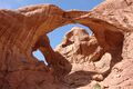
- Double Arch – two arches that share a common end
- Fiery Furnace – an area of maze-like narrow passages and tall rock columns (see biblical reference, Book of Daniel, chapter 3)
- Landscape Arch – a very thin and long arch in the Devils Garden with a span of 290 ft (88 m) (the longest arch in the park)
- Marching Men – a collection of pillars

Park Avenue in Arches National Park - Petrified Dunes – petrified remnants of dunes blown from the ancient lakes that covered the area
- Queen Nefertiti Rock – a formation at Park Avenue
- Queen Victoria Rock – a formation at Park Avenue
- Sheep Rock – a formation north of Park Avenue
- The Organ – a butte towering over the park road
- The Phallus – a rock spire that resembles a phallus
- Three Penguins – a formation near the park entrance
- Tower of Babel – a formation towering over the park road
- Wall Arch – located along the popular Devils Garden Trail; collapsed sometime on August 4/5, 2008[44][45]
- The Three Gossips –a mid-sized sandstone tower located in the Courthouse Towers area.
Gallery
-
-
 The Windows
 -
 The Organ, a sandstone tower in the Courthouse Towers area
 -
 The Three Gossips
 -
 Broken Arch
 -

-
 Navajo Arch
 -

-
 Partition Arch
 -

-
 Tunnel Arch
 -
 Sand Dune Arch
 -

-


.jpg&filetimestamp=20260822142452&)


See also
- List of national parks of the United States
- National Register of Historic Places listings in Arches National Park
- Natural Bridges National Monument - three natural bridges formed by flowing water
- Rainbow Bridge National Monument - the largest natural bridge in the Western Hemisphere
References
- ^ "Listing of acreage as of December 31, 2011". Land Resource Division, National Park Service. Retrieved 2012-03-05.
- ^ أ ب "NPS Annual Recreation Visits Report". National Park Service. Retrieved 2023-07-25.
- ^ Rowan, James. "Arches National Park". YC.edu. Yavasai College. Archived from the original on 22 August 2021. Retrieved 7 September 2016.
- ^ "Nature". NPS.gov. National Park Service. Archived from the original on 7 December 2021. Retrieved 7 September 2016.
- ^ "Arches National Park". nationalgeographic.com. 5 November 2009. Archived from the original on 5 October 2013. Retrieved 2 October 2013.
- ^ "Arches National Park". The National Parks: Index 2009–2011. National Park Service. Archived from the original on 29 June 2011. Retrieved 2011-06-08.
- ^ Crane, Ken (2025-04-19). "National Parks by Popularity 2024". Park Quest (in الإنجليزية الأمريكية). Retrieved 2025-08-01.
- ^ "Foundation Document". National Park Service. Archived from the original on 20 November 2021. Retrieved 8 June 2021.
- ^ أ ب Kiver, Eugene P.; Harris, David V. (1999). Geology of U.S. parklands (5th ed.). New York [u.a.]: J. Wiley. pp. 503–515. ISBN 0-471-33218-6.
- ^ National Geographic (2007). Guide to the national parks of the United States (5th ed.). Washington, D.C.: National Geographic Society. pp. 152–157. ISBN 978-1435129504.
- ^ Belnap, J (July 1998). "Choosing Indicators of Natural Resource Condition: a Case Study in Arches National Park, Utah, USA". Environmental Management. 22 (4): 635–642. doi:10.1007/s002679900135. PMID 9582399. S2CID 36673757.
- ^ [[1](http://npshistory.com/publications/arch/index.htm) "Arches National Park Utah"]. npshistory.com. Retrieved November 15, 2023.
{{cite web}}: Check|url=value (help) - ^ أ ب Moab, Mailing Address: PO Box 907; Us, UT 84532 Phone: 435 719-2299 Contact. [[2](https://www.nps.gov/arch/learn/photosmultimedia/geologyvideo.htm) "Geology of Arches Video - Arches National Park (U.S. National Park Service)"]. [www.nps.gov](http://www.nps.gov) (in الإنجليزية). [[3](https://web.archive.org/web/20220513204810/https://www.nps.gov/arch/learn/photosmultimedia/geologyvideo.htm) Archived] from the original on 2022-05-13. Retrieved 2022-05-13.
{{cite web}}: Check|archive-url=value (help); Check|url=value (help)CS1 maint: numeric names: authors list (link) - ^ [[4](https://login.ku.edu/cas/login?service=https%3A%2F%2Flibauth.ku.edu%2Flibauth%2Findex.php%3Furl%3Dezp.2aHR0cHM6Ly9wdWJzLmdlb3NjaWVuY2V3b3JsZC5vcmcvZ3NhL2dzYWJ1bGxldGluL2FydGljbGUvMTA2LzcvODc5LzE4Mjk0OC9Sb2xlLW9mLWZyYWN0dXJlLWxvY2FsaXphdGlvbi1pbi1hcmNoLWZvcm1hdGlvbg--) "Login - Single Sign On | The University of Kansas"]. login.ku.edu. [[5](https://web.archive.org/web/20220513204811/https://login.ku.edu/cas/login?service=https%3A%2F%2Flibauth.ku.edu%2Flibauth%2Findex.php%3Furl%3Dezp.2aHR0cHM6Ly9wdWJzLmdlb3NjaWVuY2V3b3JsZC5vcmcvZ3NhL2dzYWJ1bGxldGluL2FydGljbGUvMTA2LzcvODc5LzE4Mjk0OC9Sb2xlLW9mLWZyYWN0dXJlLWxvY2FsaXphdGlvbi1pbi1hcmNoLWZvcm1hdGlvbg--) Archived] from the original on 2022-05-13. Retrieved 2022-05-13.
{{cite web}}: Check|archive-url=value (help); Check|url=value (help) - ^ Lohman, S. W. [[6](https://www.gutenberg.org/files/51116/51116-h/51116-h.htm#c10) "The Geologic Story of Arches National Park, by S. W. Lohman: a Project Gutenberg eBook"]. [www.gutenberg.org](http://www.gutenberg.org) (in الإنجليزية). [[7](https://web.archive.org/web/20220513204811/https://www.gutenberg.org/files/51116/51116-h/51116-h.htm#c10) Archived] from the original on 2022-05-13. Retrieved 2022-05-13.
{{cite web}}: Check|archive-url=value (help); Check|url=value (help) - ^ Abbas, Mohamed Farid; Elkady, Tamer Yehia; Al-Shamrani, Mosleh Ali (2015-07-02). [[8](https://www.sciencedirect.com/science/article/abs/pii/S0013795215001283) "Evaluation of strain and stress states of a compacted highly expansive soil using a thin-walled oedometer"]. Engineering Geology (in الإنجليزية). 193: 132–145. Bibcode:2015EngGe.193..132A. doi:10.1016/j.enggeo.2015.04.012. ISSN 0013-7952. [[9](https://web.archive.org/web/20220513204813/https://www.sciencedirect.com/science/article/abs/pii/S0013795215001283) Archived] from the original on 2022-05-13. Retrieved 2022-05-13.
{{cite journal}}: Check|archive-url=value (help); Check|url=value (help) - ^ "NOWData - NOAA Online Weather Data". National Oceanic and Atmospheric Administration. Archived from the original on April 26, 2021. Retrieved June 9, 2021.
- ^ "Summary of Monthly Normals 1991-2020". National Oceanic and Atmospheric Administration. Archived from the original on 2021-11-05. Retrieved June 9, 2021.
- ^ "Arches National Park, Utah, USA - Monthly weather forecast and Climate data". Weather Atlas. Archived from the original on 7 November 2021. Retrieved 29 June 2019.
- ^ "Animals - Arches National Park (U.S. National Park Service)". Nps.gov. 2013-11-25. Archived from the original on 2014-12-24. Retrieved 2013-11-30.
- ^ "Plants - Arches National Park (U.S. National Park Service)". Nps.gov. 2013-11-25. Archived from the original on 2014-12-24. Retrieved 2013-11-30.
- ^ "Biological Soil Crust of Southeast Utah". nps.gov. National Park Service. n.d. Archived from the original on 2021-11-20. Retrieved 2018-04-19.
- ^ "Utah Park Dedicated", Deseret News 13 May 1972 pp. T-1 and T-2
- ^ Mary S. Rauch, The Newest in Science is Working To Save the Oldest in Art, Newport News Daily Press (December 28, 1980), Parade p. 16.
- ^ "Using New Techniques to Combat Graffiti (U.S. National Park Service)". www.nps.gov (in الإنجليزية). Archived from the original on 2023-02-19. Retrieved 2023-02-19.
- ^ "Rock Climbing - Arches National Park". NPS.gov. National Park Service. December 18, 2017. Archived from the original on November 24, 2021. Retrieved January 13, 2018.
- ^ "Arches announces climbing closures". May 9, 2006. Archived from the original on 2013-10-13. Retrieved 2011-06-08.
All rock climbing or similar activities on any arch or natural bridge named on the United States Geological Survey 7.5-minute topographical maps covering Arches National Park are prohibited.
- ^ Cannon, Kate (September 29, 2014). "Activities on Arches Determination - Arches National Park". NPS.gov. National Park Service. Archived from the original on August 22, 2021. Retrieved January 13, 2018.
In accordance with the provisions of 36 CFR 1.5, and the requirements of NPS Management Policies 2006 Sections 1.5 and 8.2, it is my professional judgment that it is necessary to prohibit climbing, scrambling, or walking upon, wrapping webbing or rope around, or rappelling from any arch with an opening greater than 3 feet in Arches and Canyonlands National Parks, except for Washer Woman Arch in the Island in the Sky District of Canyonlands.
- ^ "Auto Touring" Archived 2021-11-22 at the Wayback Machine. nps.gov. National Park Service. Retrieved June 29, 2019.
- ^ "Hiking" Archived 2016-10-13 at the Wayback Machine. nps.gov. National Park Service. Retrieved June 29, 2019.
- ^ "Biking" Archived 2021-11-23 at the Wayback Machine. nps.gov. National Park Service. Retrieved June 29, 2019.
- ^ "Camping" Archived 2021-11-23 at the Wayback Machine. nps.gov. National Park Service. Retrieved June 29, 2019.
- ^ "Backpacking" Archived 2021-11-21 at the Wayback Machine. nps.gov. National Park Service. Retrieved June 29, 2019.
- ^ "Canyoneering" Archived 2021-12-10 at the Wayback Machine. nps.gov. National Park Service. Retrieved June 29, 2019.
- ^ "Rock Climbing" Archived 2021-11-24 at the Wayback Machine. nps.gov. National Park Service. Retrieved June 29, 2019.
- ^ "Commercial Tours" Archived 2021-11-20 at the Wayback Machine. nps.gov. National Park Service. Retrieved June 29, 2019.
- ^ "Ranger-led Programs" Archived 2021-11-22 at the Wayback Machine. nps.gov. National Park Service. Retrieved June 29, 2019.
- ^ "Arches National Park – Lightscape/Night Sky". Archived from the original on 1 December 2010. Retrieved 2011-01-04.
- ^ "Arches National Park – Dark Sky, USA". Archived from the original on 2021-08-22. Retrieved 2011-01-04.
- ^ "Mintage Totals – 2014". usmint.gov. Archived from the original on 2021-08-22. Retrieved 2019-06-30.
- ^ Scheese, Don (1998). "Desert Solitaire: Counter-Friction to the Machine in the Garden". In Glotfelty, Cheryl; Fromm, Harold (eds.). The ecocriticism reader: landmarks in literary ecology. University of Georgia Press. p. 305. ISBN 978-0-8203-1781-6. Archived from the original on 2023-04-06. Retrieved 2019-06-30.
- ^ "Things To Do" Archived 2019-06-30 at the Wayback Machine. nps.gov. National Park Service. Retrieved June 29, 2019.
- ^ Mitchell, Joe; Coronella, Mike (2005). The Hayduke Trail: A Guide to the Backcountry. The University of Utah Press. p. 1. ISBN 0874808138.
- ^ "Wall Collapses". Arches National Park: National Park Service. August 8, 2008. Archived from the original on February 10, 2015. Retrieved August 9, 2008.
- ^ Stark, Mike (August 10, 2008). "Iconic Stone Arch Collapses in Southern Utah Park". The Washington Post. Archived from the original on March 6, 2021. Retrieved September 20, 2017.
Further reading
- Doelling, Hellmut H. (2000). Anderson, P.B.; Sprinkel, D.A (eds.). "Geologic road and trail guides to Arches National Park" (PDF). Geologic Road, Trail, and Lake Guides to Utah's Parks and Monuments. Utah Geological Association. Archived from the original (PDF) on 26 March 2014. Retrieved 2 May 2018.
- Scoon, Roger (2021). "Arches National Park and Dinosaur National Monument, Eastern Utah". The Geotraveller: Geology of Famous Geosites and Areas of Historical Interest. Cham, Switzerland: Springer. ISBN 978-3-030-54692-2.
- Webb, Roy (1994). "Arches National Park" article in the Utah History Encyclopedia. University of Utah Press. ISBN 9780874804256. Archived from the original on March 21, 2024 and retrieved on April 2, 2024.
External links
| Find more about آرتشز، المنتزه الوطني at Wikipedia's sister projects | |

|
Media from Commons |

|
Travel guide from Wikivoyage |
- Official website
- Historic American Engineering Record (HAER) documentation, filed under Moab, Grand County, UT:
- HAER No. UT-70, "Arches National Park Main Entrance Road, Beginning at U.S. Highway 191, approximately 6 miles north of Moab", 7 photos, 3 color transparencies, 23 data pages, 2 photo caption pages
- HAER No. UT-70-A, "Arches National Park Main Entrance Road, Moab Canyon Wash Culvert, Spanning Moab Canyon wash", 3 photos, 6 data pages, 1 photo caption page


سولت ليك سيتي (العاصمة) | |||||||||||||
| موضوعات |  | ||||||||||||
| المجتمع | |||||||||||||
| المناطق | |||||||||||||
| المدن الكبرى | |||||||||||||
| المقاطعات | |||||||||||||
| المعالم |
| ||||||||||||
| International | |
|---|---|
| National | |
- Pages using gadget WikiMiniAtlas
- CS1 الإنجليزية الأمريكية-language sources (en-us)
- CS1 errors: URL
- CS1 maint: numeric names: authors list
- Short description is different from Wikidata
- IUCN Category II
- Coordinates on Wikidata
- Pages using infobox protected area with unknown parameters
- Pages with empty portal template
- Official website different in Wikidata and Wikipedia
- Arches National Park
- 1929 establishments in Utah
- Colorado Plateau
- National parks in Utah
- Natural arches of Utah
- Climbing areas of Utah
- Protected areas established in 1971
- Protected areas of Grand County, Utah
- Protected areas on the Colorado River
- Natural arches of Grand County, Utah
- Geotopes
- صفحات مع الخرائط