درينيا
Deryneia | |
|---|---|
| Δερύνεια (Greek) | |
 All Saints Church, Deryneia | |
  Deryneia الموقع ضمن قبرص | |
| الإحداثيات: 35°03′20″N 33°57′25″E / 35.05556°N 33.95694°E | |
| Country |  قبرص قبرص |
| District | Famagusta |
| الحكومة | |
| • Mayor | Andros Karayiannis |
| التعداد (2011) | |
• الإجمالي | 5٬758 |
| منطقة التوقيت | UTC+2 (EET) |
| • الصيف (التوقيت الصيفي) | EEST |
| Postal code | 5380 |
| الموقع الإلكتروني | http://www.deryneia.org.cy |
دِرينيا (باليونانية: Δερύνεια؛ بالتركية: Derinya؛ إنگليزية: Deryneia) هي قرية كبيرة في جزيرة قبرص. وتقع درينيا في الجانب الشرقي للجزيرة، على بعد 2 كيلومتر جنوب مدينة فاماگوستا. The population of the village is 5,758 (October 2011 census) and it consists of a municipality since 1994. The current mayor is Andros Karayiannis. Since the 1974 Turkish invasion of Cyprus, around 75% of the village terrain is in شمال قبرص. The village is 12 kilometers from the famous resort of Ayia Napa. The "Ghost Town" of Varosha can be clearly viewed from the roof of the Cultural Centre, as can the craters from shells fired during the invasion in the field opposite.
The village has agricultural land around it, and is one of the "Kokkinochoria" (red villages) so called from the red soil. Potatoes are widely grown but Deryneia is famous for its strawberries and holds a biennial strawberry festival at the football ground of Anagennisi Deryneia on the Dherynia to Sotira road.
معرض صور
-
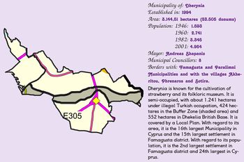 Concise presentation of Deryneia
 -
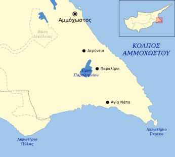 Deryneia and surrounding area


