هسپانيولا
 View from the ISS, 2011 | |
 Map of Hispaniola | |
  Hispaniola  Hispaniola  Hispaniola | |
| الجغرافيا | |
| الموقع | The Caribbean Sea |
| الإحداثيات | 19°N 71°W / 19°N 71°W |
| الأرخبيل | Greater Antilles |
| الجزر الرئيسية | |
| المساحة | 76،192 km2 (29،418 sq mi) |
| ترتيب المساحة | 22nd |
| الخط الساحلي | 3٬059 km (1٬900٫8 mi) |
| أعلى منسوب | 3٬175 m (10٬417 ft)[5] |
| أعلى نقطة | Pico Duarte |
| الإدارة | |
| Capital and largest city | Santo Domingo (pop. 1,029,117[7]) |
| المساحة المغطاة | 48،445 km2 (18،705 sq mi) |
| العاصمة وأكبر مدينة | Port-au-Prince (pop. 1,234,742) |
| المساحة المغطاة | 27،747 km2 (10،713 sq mi) |
| السكان | |
| التعداد | 22,569,800 (2024; both countries' estimates combined) |
| ترتيب التعداد | 11th |
| الكثافة السكانية | 280٫8 /km2 (727٫3 /sq mi) |
| اللغات | |
| الجماعات العرقية | |
| معلومات إضافية | |
| Time zones |
|
| • Summer (DST) |
|
جزيرة هسپانيولا هي ثاني أكبر جزر الأنتيل، وتقع شرقي كوبا. وصل كريستوفر كولمبوس على شواطئها في 5 ديسمبر 1492 م وفي رحلته الثانية أسس فيها أول مستعمرة إسبانية في العالم الجديد. تحتل هايتي ثلثها الغربي بينما تقع جمهورية الدومنيكان في ما تبقى من جزئها الشرقي. يذكر بعض المؤرخين دخول الإسلام فيها في القرن الخامس الهجري عن طريق التجار الأفارقة المسلمين [1]. وهي ثانية كبريات جزر الهند الغربية، وتقع بين كوبا وبورتوريكو في البحر الكاريبي. وتبعد حوالي 970 كم جنوب شرقي فلوريدا في الولايات المتحدة الأمريكية.
يطلق سكان الجزيرة الأصليين على الجزيرة اسم كويسكويا. مسمى هايتي أطلق في الأصل على اسم الجزيرة كلها ولم يقصد بها جزؤها الغربي فقط. كان اسم جمهورية الدومنيكان لمدة من الزمن هايتي الإسبانية.
يبلغ عدد سكان الجزيرة 15,785,316 نسمة (تقديرات 2002) منهم 7 ملايين في هاييتي و8,7 ملايين في الدومنيكان. مساحة الجزيرة الكلية هي حوالي 76,480 كم2.
تشغل جمهورية هايتي الثلث الغربي من هسبانيولا، في حين تُغَطِي جمهورية الدومينيكان ثلثيها الشرقيين. ويبلغ طول الجزيرة 640 كم، وعرضها 240 كم، وتبلغ مساحة هسبانيولا 76,456كم². وصل كريستوفر كولمبوس إلى هسبانيولا في عام 1492م وسماها أيلا إسبانيولا أي الجزيرة الأسبانية. [9]
أسماء الجزيرة
التاريخ
قبل كلومبس


The Archaic Age people arrived from mainland Central America or northern South America about 6,000 years ago and are thought to have practiced a largely hunter-gatherer lifestyle. During the 1st millennium BC, the Arawakan-speaking ancestors of the Taino people began to migrate into the Caribbean. Unlike the Archaic peoples, they practiced the intensive production of pottery and agriculture. The earliest evidence the Ortoiroid people, which dates to around 600 AD.[10] The Taino represented the dominant group on the island during the period of European contact.[11] Each society was a small independent kingdom with a leader known as a cacique.[12] In 1492, which is considered the peak of the Taíno, five different kingdoms ruled over the island,[11] the Xaragua, Higuey (Caizcimu), Magua (Huhabo), Ciguayos (Cayabo or Maguana), and Marien (Bainoa).[12] Many distinct Taíno languages also existed in this time period.[13] There is still heated debate over the population of Taíno in 1492, but estimates range from no more than a few tens of thousands, according to a 2020 genetic analysis,[14][15] to upwards of 750,000.[16]
A Taíno home consisted of a circular building with woven straw and palm leaves as covering.[12] Most individuals slept in fashioned hammocks, but grass beds were also used.[11] The cacique lived in a different structure with larger rectangular walls and a porch.[12] The Taíno village also had a flat court used for ball games and festivals.[12] Religiously, the Taíno people were polytheists, and their gods were called Zemí.[12] Religious worship and dancing were common, and medicine men or priests also consulted the Zemí for advice in public ceremonies.[12]
For food, the Taíno relied on meat and fish as a primary source for protein.[17] On the island they hunted small mammals, but also snakes, worms, and birds. In lakes and in the sea they were able to catch ducks and turtles.[12] The Taíno also relied on agriculture as a primary food source.[17] They raised crops in a conuco, which is a large mound packed with leaves and fixed crops to prevent erosion.[12] Some common agricultural goods were cassava, maize, squash, beans, peppers, peanuts, cotton, and tobacco, which was used as an aspect of social life and religious ceremonies.[12]

The Taíno people traveled often and used hollowed canoes with paddles when on the water for fishing or for migration purposes,[12] and upwards of 100 people could fit into a single canoe.[11] The Taíno came frequently in contact with the Caribs, another indigenous tribe.[12] The Taíno people used bows and arrows with poisoned tips and some war clubs.[12] When Columbus landed on Hispaniola, many Taíno leaders wanted protection from the Caribs.[12]
بعد كلومبس


عام 1504، كان كريستوفر كولومبوس قد اكتشف جزيرة جامايكا (في البحر الكاريبي)، بعد أن كان اكتشف جزيرة هسپانيولا. وبين الجزيرتين تقع جزيرة صغيرة ومغمورة ومن دون ماء عذب. وسماها كولومبوس نافا (من دون ماء، جرداء). ولأكثر من أربعمائة سنة، أهملت الجزيرة، ولم تظهر حتى في كثير من خرائط المنطقة. لكن، الآن، تنازع عليها هايتي وجمايكا.
خلال سنوات، كانت الولايات المتحدة تعتبرها تابعة لها، لأنها قريبة من كوبا التي استعمرتها الولايات المتحدة مع بداية القرن 20 (بعد أن هزمت إسبانيا فيها). غير أن الولايات المتحدة أهملت الجزيرة بعد أن حصلت على قاعدة گوانتانامو في كوبا. وفي الوقت الحاضر، لا تميل الولايات المتحدة إلى هايتي أو إلى جمايكا في النزاع حول الجزيرة الجرداء.[18]
حصل الفرنسيون على الجزء الغربي من الجزيرة (هايتي) وفقا لمعاهدة رايسويك واهتموا بها تجاريا ونتيجة لذلك فقد تفوقت هايتي على جارتها اقتصاديا ومن ناحية عدد السكان وبقي عدد السكان في هايتي أكبر حتى حلول عام 1970. قامت محاولتان من قبل الهايتيين باحتلال الجزء الشرقي من الجزيرة.
القرنان 18 و 19: الاستقلال

European colonists often died young due to tropical fevers, as well as from violent slave resistance in the late 18th century. In 1791, during the French Revolution, a major slave revolt broke out on Saint-Domingue. When the French Republic abolished slavery in the colonies on February 4, 1794, it was a European first.[19] The ex-slave army joined forces with France in its war against its European neighbors. In the second 1795 Treaty of Basel (July 22), Spain ceded the eastern two-thirds of the island of Hispaniola, later to become the Dominican Republic. French settlers had begun to colonize some areas in the Spanish side of the territory.[citation needed]
Under Napoleon, France reimposed slavery in most of its Caribbean islands in 1802 and sent an army to bring the island into full control. However, thousands of the French troops succumbed to yellow fever during the summer months, and more than half of the French army died because of disease.[20] After an extremely brutal war with atrocities committed on both sides, the French removed the surviving 7,000 troops in late 1803, and the surviving leaders of the Haitian Revolution declared western Hispaniola the new nation of independent Haiti in early 1804. France continued to rule Spanish Santo Domingo. In 1805, after renewed hostilities with the ruling French government in Santo Domingo, Haitian troops of General Jean Jacques Dessalines tried to conquer all of Hispaniola. He launched an invasion of Santo Domingo and sacked the towns of Santiago de los Caballeros and Moca, killing most of their residents, but news of a French fleet sailing towards Haiti forced the invading army to withdraw from the east, leaving it in French hands.


In 1808, a second revolution against France broke out on the island. Following Napoleon's invasion of Spain, the criollos of Santo Domingo revolted against the French regime. With the aid of Great Britain, the French was defeated, and Santo Domingo was returned to Spanish control. France would never regain control of the island, and after some 12 years of Spanish dominion, the leaders in Santo Domingo revolted again, and eastern Hispaniola was declared independent as the Republic of Spanish Haiti in 1821. Fearing the influence of a society of slaves that had successfully revolted against their owners, the United States and European powers refused to recognize Haiti, the second republic in the Western Hemisphere. France demanded a high payment for compensation to slaveholders who lost their property, and Haiti was saddled with unmanageable debt for decades.[21] By this point, the entire island was united under Haitian control. However, suppression of the Dominican culture and the imposition of heavy taxation would lead to the Dominican War of Independence and the establishment of the Dominican Republic in 1844. (This is one of the reasons for the tensions between the two countries today). Years of war, political chaos and economic crisis came to an end with a reintegration of the Dominican Republic to Spanish rule in 1861, at the request of discouraged Dominican political leaders who had hoped that the Spanish would restore order to the country. However, just as in the España Boba period, taxations, corruption, and second class treatment of the Dominicans caused support for the regime to wane, and new independence movements had sparked throughout the country. In August 1863, the Dominican Restoration War erupted on the island, and after suffering heavy defeats, the Spanish Crown capitulated. A royal decree, the Treaty of El Carmelo, recognized the independence of the Dominican Republic, and the Spanish were expelled for good in 1865. Renewed annexation projects, this time to the United States, was defeated in Congress, and the masterminds were ousted in an uprising in 1874. Both states have remained independent since then.
20th century to present: Foreign intervention, dictatorships, aftermath
In the 20th century, however, both states have endured similar outcomes. With many ensuing conflicts such as Banana Wars and World War I taking place, political and economic instabilities continued to ravage as constant power struggles and civil wars engulfed among leaders in both states. Such actions triggered renewed external interest in launching military interventions on the island. This would finally come with U.S. forces issuing a military occupation of both states, first with Haiti in 1915, and the Dominican Republic in 1916. In the following decades after American forces departed from the island, both states would be ruled by heavy handed politicians that had risen to prominence during the American occupation. Haiti's François Duvalier (Papa Doc) and his son, Jean-Claude Duvalier (Baby Doc) and Dominican Republic's Rafael Trujillo would emerge as the leading autocratic rulers at this time. Eventually, the dictatorships of both countries came to a close with the assassination of Trujillo in 1961, (which plunged the country into chaos, triggering a bloody revolution and a second U.S intervention in 1965), and the death of François Duvalier and overthrow of Jean-Claude Duvalier in 1971 and 1986, respectively. Both states would return to a democratic government, as proven with the elections of Jean-Bertrand Aristide in Haiti, and Joaquín Balaguer in the Dominican Republic. From this point forward, however, the two countries underwent two distinct paths, both politically and economically. While the Dominican Republic was able to recover from the political crisis that ravaged the country since its conception in 1844, Haiti's political crisis continued to destabilize. The political chaos that erupted following the overthrow of Aristide in 2004 caused a mass intervention by the U.N., which lasted until 2017. Even by that point, Haiti had already suffered a massive catastrophic earthquake in 2010, cholera outbreaks continued, and gang violence had escalated further, which is still ongoing to this day.
Haiti would become one of the poorest countries in the Americas, while the Dominican Republic[21] gradually has developed into one of the largest economies of Central America and the Caribbean.
الجغرافيا

إلى الشمال الغربي من جزيرة هسبانيولا تقع كوبا ويفصل بينهما ممر وندوارد وإلى الجنوب الشرقي منها تقع جامايكا ويفصل بينهما قناة جامايكا. تقع جزر البهاماس شمال الجزيرة.
جزر كوبا وجامايكا وهسبانيولا وبورتوريكو مجمتعة يشكلوا ما يعرف باسم جزر الأنتيل الكبرى المكونة من الصخور القارية.
الجزيرة ذات طابع جبلي بشكل عام وفيها 5 سلاسل جبلية: الجبال الوسطى والتي تمتد من الشاطئ الجنوبي للدومانيكان حتى الأجزاء الشمالية الغربية من هاييتي. في سلسلة الجبال الوسطى أعلى قمة في جزر الأنتيل كافة وهي بيكو دوارتي (3,087 مترا فوق سطح البحر). كورديليرا سبتنتينورال وتمتد موازية للسلسلة الوسطى من النهاية الجنوبية لجمهورية الدومنيكان حتى المحيط الأطلسي وشبه جزيرة سامانا. يفصل بين السلسلة الوسطى والسبتنتينورال واد يسمى كيباو وسهول الأطلسي الشاطئية. سلسلة الجبال الشرقية هي أكثر الجبال انخفاضا في الجزيرة وتقع شرقيها. السييرا دي نيبا تبرز في الأجزاء الجنوبية الغربية للدومنيكان وتكمل حتى الأجزاء الجنوبية الغربية من هاييتي على موازاة الجبال الوسطى.
-
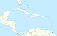 Caribbean locations
 -
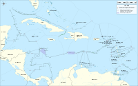 Caribbean maritime boundaries
 -
 Antilles
 -
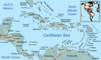 Caribbean general map and map of the Caribbean Sea
 -
 Bay of Samana Province in the northeastern region of the Dominican Republic
 -
 Bay of Samana Province in the northeastern region of the Dominican Republic


.jpg&filetimestamp=20260907193335&)
.jpg&filetimestamp=20260907193505&)
المناخ


مناخ هسبانيولا بشكل عام رطب استوائي. تغطي منطقة الغابات الهسبانيولية الرطبة نصف مساحة الجزيرة وتتركز في الأجزاء الشمالية والشرقية. تحتل منطقة الغابات الهسبانيولية الجافة 20% من مساحة الجزيرة وتقع في الأجزاء الغربية والجنوبية وتمتد لتصل لوادي الكيباو في شمال وسط الجزيرة. منطقة الغابات الصنوبرية الهسبانيولية توجد في مساحة تقدر بـ15% من مساحة الجزيرة على أراض جبلية ذات ارتفاع يربو على الثمان مئة وخمسين مترا. بقية أراضي الجزيرة عشبية (سافانا) وتتوزع في مناطق مختلفة من الجزيرة وتحوي هذه الأراضي العديد من البرك والبحيرات كبحيرة إنركويلو في الدومنيكان وسوماتري في هايتي.
-
 Salto de Jalda in Hato Mayor, Dominican Republic, the tallest waterfall in the Caribbean
 -

-
 Frosted alpine forest in Constanza, Dominican Republic
 -
 Tropical rainforest climate in Samana, Dominican Republic
 -
 Semi-arid climate in Pedernales, Hispaniolan dry forests, Dominican Republic and Haiti
 -
 Desert sand dunes of Baní, Dominican Republic
 -
 Cordillera Central in the Dominican Republic has the highest elevation of the Caribbean
 -
 Lake Enriquillo, Dominican Republic
 -
 Lake Enriquillo is the biggest saltwater—hypersaline lake in the Dominican Republic. It is located in Enriquillo wetlands, and is the largest lake in both the Dominican Republic and Hispaniola, as well as the entire Caribbean. At 46-meters below sea level, it is the lowest point on the island or any island country.
 -
 Yaque del Norte river, Dominican Republic
 -
 Oviedo Lake in Pedernales, Dominican Republic
 -
 Hispaniolan moist forests, hills north of Santiago de los Caballeros, Dominican Republic and Haiti
 -
 Hispaniolan pine forests as seen from Pico Duarte, Dominican Republic and Haiti
 -


_Saman%C3%A1,_DR.JPG&filetimestamp=20231102061856&)
.JPG&filetimestamp=20231102055151&)


الوحيش
There are many bird species in Hispaniola, and the island's amphibian species are also diverse. There are many species endemic to the island including insects and other invertebrates, reptiles, amphibians, fishes, birds and mammals (originally animals, native animals) and also (imported animals, introduced animals, not native animals or invasive species) like farm animals, transport animals, house animals, pets and more. The two endemic terrestrial mammals on the island are the Hispaniolan hutia (Plagiodontia aedium) and the Hispaniolan solenodon (Solenodon paradoxus). There are also many birds on the island, with six endemic genera (Calyptophilus, Dulus, Nesoctites, Phaenicophilus, Xenoligea and Microligea). More than half of the original distribution of its ecoregions has been lost due to habitat destruction impacting the local fauna and some of the original animals either threat, threatened with extinction or totally extinct, because of climate change or because they have been hunted by humans or their habitats have been felled or changed for some reasons or have become some of the animals have been threatened by (introduced animals, not native animals or invasive species) or there are fighting for space to survive and perhaps some animals that feed on the same plants or animals or just something like that.[22]
النبيت

The island has four distinct ecoregions. The Hispaniolan moist forests ecoregion covers approximately 50% of the island, especially the northern and eastern portions, predominantly in the lowlands but extending up to 2،100 متر (6،900 ft) elevation. The Hispaniolan dry forests ecoregion occupies approximately 20% of the island, lying in the rain shadow of the mountains in the southern and western portion of the island, and in the Cibao valley in the center-north of the island. The Hispaniolan pine forests occupy the mountainous 15% of the island, above 850 متر (2،790 ft) elevation. The flooded grasslands and savannas ecoregion in the south central region of the island surrounds a chain of lakes and lagoons, the most notable of which are Etang Saumatre and Trou Caïman in Haiti and the nearby Lake Enriquillo in the Dominican Republic.
In Haiti, deforestation has long been cited by scientists as a source of ecological crisis; the timber industry dates back to French colonial rule. Haiti has seen a dramatic reduction of forests due to the excessive and increasing use of charcoal as fuel for cooking. Various media outlets have suggested that the country has just 2% forest cover, but this has not been substantiated by research.[23]
Also extremely important are the rarely mentioned species of Pinguicula casabitoana (a carnivorous plant), Gonocalyx tetraptera, Gesneria sylvicola, Lyonia alaini and Myrcia saliana, as well as palo de viento (Didymopanax tremulus), jaiqui (Bumelia salicifolia), pino criciolio (Pino criciol), sangre de pollo (Mecranium amigdalinum) and palo santo (Alpinia speciosa).
According to reports in the Dominican Republic and Haiti, the flora in this naturally protected area consists of 621 species of vascular plants, of which 153 are highly endemic to Hispaniola. The most prominent endemic species of flora that abound in the area are ebano verde (green ebony), Magnolia pallescens, a highly endangered hardwood.
Recent in-depth studies of satellite imagery and environmental analysis regarding forest classification conclude that Haiti actually has approximately 30% tree cover;[24] this is, nevertheless, a stark decrease from the country's 60% forest cover in 1925. The country has been significantly deforested over the last 50 years, resulting in the desertification of many portions of Haiti. Haiti's poor citizens use cooking fires often, and this is a major culprit behind the nation's loss of trees. Haitians use trees as fuel either by burning the wood directly, or by first turning it into charcoal in ovens. Seventy-one percent of all fuel consumed in Haiti is wood or charcoal.[25] Haiti's government began establishing protected areas across the country in 1968. These 26 areas today represent nearly 7 per cent of the country's land and 1.5 per cent of its waters.[26]
In the Dominican Republic, the forest cover has increased. In 2003, the Dominican Republic's forest cover had been reduced to 32% of its land area, but by 2011, forest cover had increased to nearly 40%. The success of the Dominican forest growth is due to several Dominican government policies and private organizations for the purpose of reforesting, and a strong educational campaign that has resulted in increased awareness by the Dominican people of the importance of forests for their welfare and other forms of life on the island.[27]
السكان
يبلغ عدد سكان هسْبَانيولا حوالي ثلاثة عشر مليون نسمة، وكلهم تقريبًا إما سود، وإما ينحدرون من أصول مختلطة من البيض والسود. ويعيش أكثر من نصف السكان في المناطق الريفية، ويعتمدون على الزراعة، ويمثل البن، وقصب السكر المحصولين الرئيسيين.
الإسلام في هسبانيولا
يخبر إيفان سيرتيما صاحب كتاب هم قدموا قبل كولومبوس:الوجود الإسلامي في أمريكا القديمة بأن المسلمين الأفارقة قدموا إلى الجزيرة قبل كريستوف كولومبوس وأن السكان الأصليين الحاليين يعترفون بأن أول من قدم إلى الجزيرة هم الأفارقة. كما أن المسلمين الأفارقة اندمجوا مع السكان الأصليين للبلاد ودخل منهم عدد كبير فيه.
تدفق عدد من العبيد المسلمين إلى الجزيرة على يد الإسبان فقاموا بثورة ضدهم في 1522 م فقامت إسبانيا بمعاونة السكان الأصليين بقمعها. وفيها قال دييجو كولومبوس «إن لم تقمع الثورة بسرعة لكانت قد أريقت دماء المزيد من المسيحيين». قامت إسبانيا بإجلاء المسلمين عن الجزيرة وإبعادهم عنها.
التركيب العرقي
The ethnic composition of the Dominican population is 73% Mulatto or mixed ethnicity,[28] 16% white and 11% black. Descendants of early Spanish settlers and of black slaves from West/Central Africa constitute the two main racial strains. This genetic pattern reflects the societal organization of the former Spanish colonies, such as the Dominican Republic, characterized by a high degree of interethnic relationships between European men and Native American/Taino or African women. Government policy under the Spanish Crown did not prohibit interethnic relationships throughout the colony.[29]
At an individual level, Mulattos in the Dominican Republic tend to be approximately 50-60% European, 40-50% Sub-Saharan African, and 8-10% Native American (Taíno).[30]
The ethnic composition of Haiti is estimated to be 95% black and 5% white and Mulatto.
The 19:1 ratio of blacks to whites is correlated with the societal organization of former French colonies, such as Haiti. In the British and French colonies, the segregation of slaves was stronger than in the Spanish territories as interethnic marriages were prohibited and no rights were recognized to children of parents of different ethnicity. Therefore, in the former British and French territories, the separation between the two main groups (i.e. European colonists and African slaves) was sharper and the admixture reduced.[29]
In addition, a slave rebellion broke out in the colony that eventually ended with the independence of Haiti and a massacre of most of the white population.[31] This is reflected by the mtDNA and Y haplogroup composition of the Haitians.[32]
In recent times, Dominican and Puerto Rican researchers identified in the current Dominican population the presence of genes belonging to the aborigines of the Canary Islands (commonly called Guanches).[33] These genes also have been detected in Puerto Rico.[34]
الاقتصاد


The island has the largest economy in the Greater Antilles; however, most of the economic development is found in the Dominican Republic, the Dominican economy being above 1000% larger than the Haitian economy. اعتبارا من 2025[تحديث], the estimated annual per capita income is US$3040 in Haiti and US$30,870 in the Dominican Republic.[35][36]
The divergence between the level of economic development in Haiti and the Dominican Republic makes its border the highest contrast of all western land borders.[37]
الموارد الطبيعية
The island also has an economic history and current day interest and involvement in precious metals. In 1860, it was observed that the island contained a large supply of gold, which the early Spaniards had hardly developed.[38] By 1919, Condit and Ross noted that much of the island was covered by government granted concessions for mining different types of minerals. Besides gold, these minerals included silver, manganese, copper, magnetite, iron and nickel.[39]
Mining operations in 2016 have taken advantage of the volcanogenic massive sulfide ore deposits around Maimón. To the northeast, the Pueblo Viejo Gold Mine was operated by state-owned Rosario Dominicana from 1975 until 1991. In 2009, Pueblo Viejo Dominicana Corporation, formed by Barrick Gold and Goldcorp, started open-pit mining operations of the Monte Negro and Moore oxide deposits. The mined ore is processed with gold cyanidation. Pyrite and sphalerite are the main sulfide minerals found in the 120-meter thick volcanic conglomerates and agglomerates, which constitute the world's second largest sulphidation gold deposit.[40]
Between Bonao and Maimón, Falconbridge Dominicana has been mining nickel laterites since 1971. The Cerro de Maimon copper/gold open-pit mine southeast of Maimón has been operated by Perilya since 2006. Copper is extracted from the sulfide ores, while gold and silver are extracted from both the sulfide and the oxide ores. Processing is via froth flotation and cyanidation. The ore is located in the VMS Early Cretaceous Maimón Formation. Goethite enriched with gold and silver is found in the 30-meter thick oxide cap. Below that cap is a supergene zone containing pyrite, chalcopyrite, and sphalerite. Below the supergene zone is found the unaltered massive sulphide mineralization.[41]
التنمية البشرية
هذه هي قائمة بمناطق جمهورية الدومنيكان و هايتي حسب مؤشر التنمية البشرية في 2018.[42]
| الترتيب | المنطقة | ت.ب. 2018 | البلد |
|---|---|---|---|
| تنمية بشرية مرتفعة | |||
| 1 | South Metro | 0.764 | جمهورية الدومنيكان |
| 2 | Cibao North | 0.755 | جمهورية الدومنيكان |
| 3 | North-East | 0.745 | جمهورية الدومنيكان |
| 4 | Valdesia | 0.744 | جمهورية الدومنيكان |
| 5 | Center | 0.737 | جمهورية الدومنيكان |
| 6 | يوما | 0.728 | جمهورية الدومنيكان |
| 7 | Enriquillo | 0.706 | جمهورية الدومنيكان |
| تنمية بشرية متوسطة | |||
| 8 | El Valle | 0.697 | جمهورية الدومنيكان |
| 9 | North-West | 0.694 | جمهورية الدومنيكان |
| تنمية بشرية منخفضة | |||
| 10 | Ouest Metro | 0.535 | هايتي |
| 11 | North | 0.516 | هايتي |
| 12 | North-West | 0.493 | هايتي |
| 13 | North-East | 0.492 | Haiti |
| 14 | South | 0.487 | هايتي |
| 15 | South-East | 0.481 | هايتي |
| 16 | Grande-Anse | 0.471 | هايتي |
| 17 | Artibonite | 0.469 | هايتي |
| 18 | Centre | 0.454 | هايتي |
-
 Santo Domingo in South Metro
 -
 Santiago de los Caballeros in Cibao North
 -
 Port-au-Prince in Ouest Metro
 -
 Cap Haitien in Nord


Notes
انظر أيضا
- قائمة الجزر المنقسمة
- جغرافيا هايتي
- جغرافيا جمهورية الدومنيكان
- France–Haiti relations
- Haiti–United States relations
- Dominican Republic–Spain relations
- Casa de Contratación
- Dominican Republic–Haiti border
- History of Haiti
- History of the Dominican Republic
- Dominican Republic–Haiti relations
- Geology of Haiti
- Geology of the Dominican Republic
- History of the Caribbean
- List of divided islands
- French colonization of the Americas
- Spanish colonization of the Americas
- French West Indies
- Spanish West Indies
المصادر
- ^ أ ب "¿Cuál es el nombre de nuestra isla?". www.diariolibre.com. September 29, 2012. Retrieved 2025-06-04.
- ^ Casas, Bartolomé de las (1875) [1527]. "Capitulo LXXXIV". In Sancho Rayón, José; Ramírez de Arellano, Feliciano (eds.). Historia de las Indias (in Spanish). Vol. II. Madrid. p. 7.
{{cite book}}: CS1 maint: location missing publisher (link) CS1 maint: unrecognized language (link) - ^ Colón, Fernando (1892) [1537]. Historia del almirante don Cristóbal Colón en la cual se da particular y verdadera relación de su vida y de sus hechos, y del descubrimiento de las Indias occidentales, Ilamadas nuevomundo; escrita por don Fernando Colón, su hijo . (in Spanish). Madrid. pp. 124–127, 285–287.
{{cite book}}: CS1 maint: location missing publisher (link) CS1 maint: unrecognized language (link) - ^ Anghiera, Pietro Martire d' (1533). P. De orbe nouo Petri Martyris ab Angleria Mediolanensis Protonotarij Cesaris senatoris decades. pp. 25, 58.
- ^ "Field Listing—Elevation extremes". The World Factbook. Central Intelligence Agency. Archived from the original on June 13, 2007.
- ^ قالب:Cite World Factbook
- ^ "Provincias Dominicanas" (PDF). Retrieved 5 December 2024.
- ^ قالب:Cite World Factbook
- ^ الموسوعة المعرفية الشاملة
- ^ Fernandes, Daniel M.; Sirak, Kendra A.; Ringbauer, Harald; Sedig, Jakob; Rohland, Nadin; Cheronet, Olivia; Mah, Matthew; Mallick, Swapan; Olalde, Iñigo; Culleton, Brendan J.; Adamski, Nicole; Bernardos, Rebecca; Bravo, Guillermo; Broomandkhoshbacht, Nasreen; Callan, Kimberly (2021-02-04). "A genetic history of the pre-contact Caribbean". Nature. 590 (7844): 103–110. Bibcode:2021Natur.590..103F. doi:10.1038/s41586-020-03053-2. ISSN 0028-0836. PMC 7864882. PMID 33361817.
- ^ أ ب ت ث Poole, Robert (2011). "What Became of the Taíno?". Smithsonian. 70. ProQuest 897718111.
- ^ أ ب ت ث ج ح خ د ذ ر ز س ش ص Corbett, Bob (1995). "The History of Haiti". Retrieved November 20, 2018.
- ^ Berman, Mary (2008). "The Greater Antilles and Bahamas" (PDF). In Pearsall, Deborah M. (ed.). Encyclopedia of Archaeology (1 ed.). Oxford, UK: Elsevier Science & Technology. doi:10.1016/B978-012373962-9.00391-5. ISBN 9780123739629. Archived from the original (PDF) on 2021-06-03 – via Credo Reference.
- ^ Reich, David; Patterson, Orlando (2020-12-23). "Opinion | Ancient DNA Is Changing How We Think About the Caribbean". The New York Times. ISSN 0362-4331. Retrieved 2020-12-24.
- ^ Fernandes, Daniel M.; Sirak, Kendra A.; Ringbauer, Harald; Sedig, Jakob; Rohland, Nadin; Cheronet, Olivia; Mah, Matthew; Mallick, Swapan; Olalde, Iñigo; Culleton, Brendan J.; Adamski, Nicole (2020-12-23). "A genetic history of the pre-contact Caribbean". Nature. 590 (7844): 103–110. Bibcode:2021Natur.590..103F. doi:10.1038/s41586-020-03053-2. ISSN 1476-4687. PMC 7864882. PMID 33361817.
- ^ Holguín (2010). 21st Century Anthropology: A Reference Handbook. Thousand Oaks, CA, USA: Sage Publications. ISBN -9781412957380.
- ^ أ ب Cook, Noble David (2005). "Taino (Arawak) Indians". Encyclopedia of Genocide and Crimes Against Humanity. Vol. 3. Macmillan Reference.
- ^ "نزاع الجزر". جريدة الشرق الأوسط. 2012-09-21. Retrieved 2012-09-23.
- ^ Popkin, Jeremy D. (2008) Facing Racial Revolution: Eyewitness Accounts of the Haitian Insurrection. pp. 184–213. ISBN 0226675831
- ^ Bollet, A.J. (2004). Plagues and Poxes: The Impact of Human History on Epidemic Disease. Demos Medical Publishing. pp. 48–49. ISBN 1-888799-79-X.
- ^ أ ب Diamond, Jared M. and Robinson, James A. (2011) Natural Experiments of History. pp. 126–128. ISBN 9780674060197
- ^ "The island of Hispaniola in the Caribbean". World Wildlife Fund. Retrieved أكتوبر 4, 2018.
- ^ O'Connor, M. R., ed. (13 October 2016). "One of the Most Repeated Facts about Haiti is a Lie". Vice News.
- ^ "Haiti is Covered with Trees". EnviroSociety. Tarter, Andrew. May 19, 2016. Retrieved 19 May 2016.
- ^ "After the earthquake: Haiti's deforestation needs attention". Christian Science Monitor.
- ^ "In Haiti, communities take aim at deforestation". June 3, 2021.
- ^ "República Dominicana aumenta su cobertura boscosa a 39.7% - Fundación Global Democracia y Desarrollo". Archived from the original on April 5, 2019. Retrieved October 27, 2014.
- ^ "DOMINICAN REPUBLIC". Encyclopedia of the Nations.
- ^ أ ب D’Atanasio, Eugenia; Trionfetti, Flavia; Bonito, Maria; Sellitto, Daniele; Coppa, Alfredo; Berti, Andrea; Trombetta, Beniamino; Cruciani, Fulvio (2020-09-01). "Y Haplogroup Diversity of the Dominican Republic: Reconstructing the Effect of the European Colonization and the Trans-Atlantic Slave Trades". Genome Biology and Evolution. 12 (9): 1579–1590. doi:10.1093/gbe/evaa176. ISSN 1759-6653. PMC 7523727. PMID 32835369.
- ^ Estrada-Veras, Juvianee I.; Cabrera-Peña, Giselle A.; Pérez-Estrella de Ferrán, Ceila (May 2016). "Medical genetics and genomic medicine in the Dominican Republic: challenges and opportunities". Molecular Genetics & Genomic Medicine. 4 (3): 243–256. doi:10.1002/mgg3.224. ISSN 2324-9269. PMC 4867558. PMID 27247952.
- ^ Coupeau, Steeve (2007). The History of Haiti. doi:10.5040/9798400664830. ISBN 979-8-4006-6483-0.
- ^ D’Atanasio, Eugenia; Trionfetti, Flavia; Bonito, Maria; Sellitto, Daniele; Coppa, Alfredo; Berti, Andrea; Trombetta, Beniamino; Cruciani, Fulvio (2020-09-01). Huerta-Sanchez, Emilia (ed.). "Y Haplogroup Diversity of the Dominican Republic: Reconstructing the Effect of the European Colonization and the Trans-Atlantic Slave Trades". Genome Biology and Evolution (in الإنجليزية). 12 (9): 1579–1590. doi:10.1093/gbe/evaa176. ISSN 1759-6653. PMC 7523727. PMID 32835369.
- ^ "Un estudio descubre la presencia de genes guanches en la República Dominicana | soitu.es". www.soitu.es.
- ^ "La Comunidad » Documentales Gratis » Un Estudio Del Genoma Taino Y Guanche. Adn O Dna. Primera parte". February 6, 2010. Archived from the original on February 6, 2010.
- ^ Bello, Marisol (January 21, 2010). "Hispaniola comparison". USA Today. Retrieved 2016-10-09.
- ^ "GDP per capita (current US$) - Haiti | Data". data.worldbank.org. Retrieved 2020-04-05.
- ^ Group, Samana (2024-02-08). "The Divergent Paths of Haiti and the Dominican Republic • Samana Group". Samana Group (in الإنجليزية الأمريكية). Retrieved 2025-06-12.
- ^ Courtney, W.S. (1860). The Gold Fields of St. Domingo. New York: Anson P. Norton. pp. 123–125.
- ^ Condit, D. Dale; Ross, Clyde P. (1921). Economic Geology, Chapter X, in A Geological Reconnaissance of the Dominican Republic. Washington: United States Geological Survey. p. 228.
- ^ "Pueblo Viejo Gold Mine, Dominican Republic". mining-technology.com. Retrieved 28 December 2016.
- ^ "Cerro de Maimon". Perilya.com. Retrieved 28 December 2016.
- ^ "Sub-national HDI - Area Database - Global Data Lab". hdi.globaldatalab.org. Retrieved 2018-09-13.
- مقالة هسبانيولا من ويكيبيديا الإنجليزية.
- هسبانيولا أرض الإسلام الخصبة
- الإسلام في جمهورية الدومنيكان من ويكيبيديا الإنجليزية
وصلات خارجية
- Google maps
- The portal for the Dominican Republic, created by the Fundación Global Democracia y Desarrollo and the Global Foundation for Democracy and Development. It aims to present the country in all its splendor on a national and international scale, providing up-to-date and relevant information.]
- Pages using gadget WikiMiniAtlas
- CS1 maint: location missing publisher
- CS1 الإنجليزية الأمريكية-language sources (en-us)
- Short description is different from Wikidata
- Articles with hatnote templates targeting a nonexistent page
- Missing redirects
- Articles containing إسپانية-language text
- Articles containing فرنسية-language text
- Articles containing Haitian Creole-language text
- Articles containing Taino-language text
- Coordinates on Wikidata
- Pages using infobox islands with an ambiguous map caption
- Pages using multiple image with auto scaled images
- Articles with unsourced statements from December 2018
- مقالات فيها عبارات متقادمة منذ 2025
- جميع المقالات التي فيها عبارات متقادمة
- Pages with empty portal template
- مناطق منقسمة
- الأنتيل الأعظم
- جزر دولية
- جزر الكاريبي
- جغرافيا الدومنيكان
- جغرافيا هايتي